Manor Park Suburbs & Region, Manor Park Map & Postcodes in Manor Park, Lower Hutt City, Wellington
Manor Park Postcodes, Manor Park ZipCodes, Manor Park , Manor Park Wellington, Manor Park Suburbs, Manor Park Region, Manor Park Map, Manor Park Area
Manor Park Region
Manor Park Suburbs
Manor Park is a suburb place type in Lower Hutt City, Wellington, NZ. It contains 0 suburbs or localities.Manor Park Postcodes
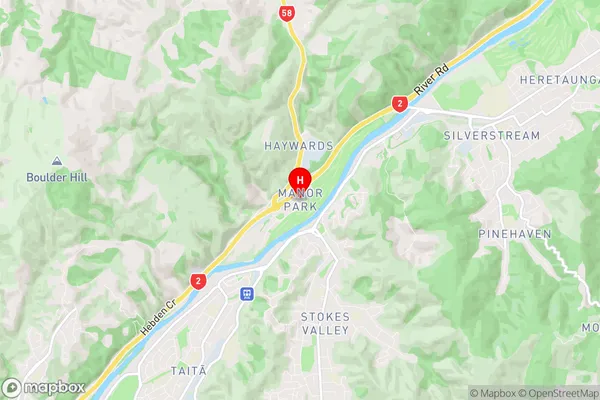
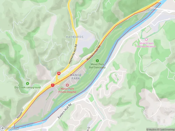
Manor Park Region Map
Manor Park Introduction
Manor Park is a historic suburb of Wellington, New Zealand, located in the eastern part of the city. It is known for its well-preserved colonial architecture and leafy streets. The suburb was developed in the late 19th century as a residential area for the city's upper-class families. It features a variety of historic buildings, including churches, government buildings, and private residences. Manor Park is also home to the Wellington Zoo, which is one of New Zealand's oldest zoos. The suburb is surrounded by parks and gardens, including the popular Thorndon Park and the Botanic Garden. It is a popular area for walking and cycling, and is close to the city's central business district and other attractions.Manor Park Region
Manor Park City
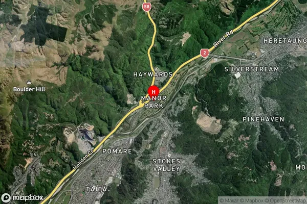
Manor Park Satellite Map
Full Address
Manor Park, Lower Hutt City, WellingtonManor Park Coordinates
-41.157284,174.978883 (Latitude / Longitude)Manor Park Map in NZ
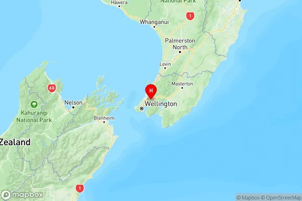
NZ Island
North IslandCountry
Manor Park Area Map (Polygon)
Name
Manor ParkAdditional Name
Local Authority
Lower Hutt City
Manor Park Suburbs (Sort by Population)
Manor Park suburb has around
1.3 square
kilometers.There are more than 370 people (estimated)
live in Manor Park, Lower Hutt, Wellington, New Zealand.