Moturoa / Rabbit Island Area, Moturoa / Rabbit Island Postcode & Map in Moturoa / Rabbit Island
Moturoa / Rabbit Island Area, Moturoa / Rabbit Island Postcode & Map in Moturoa / Rabbit Island, Tasman District,
Moturoa / Rabbit Island, Tasman District,
Moturoa / Rabbit Island Area (estimated)
15.9 square kilometersMoturoa / Rabbit Island Population (estimated)
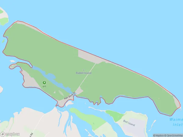
10 people live in Moturoa / Rabbit Island, Richmond, NZMoturoa / Rabbit Island Suburb Area Map (Polygon)
Moturoa / Rabbit Island Introduction
Moturoa Island is a small, privately owned island in the Richmond Range of the Tasman Islands. It is known for its beautiful beaches, clear waters, and diverse wildlife, including rabbits, which are the island's namesake. The island has a population of around 50 people and is accessible by ferry from Richmond. It is a popular destination for tourists and outdoor enthusiasts alike, with opportunities for hiking, snorkeling, and fishing.Region
Major City
Suburb Name
Moturoa / Rabbit IslandMoturoa / Rabbit Island Area Map (Street)
Local Authority
Tasman DistrictFull Address
Moturoa / Rabbit Island, Tasman District,Address Type
Island in Town RichmondMoturoa / Rabbit Island Suburb Map (Satellite)
Country
Main Region in AU
TasmanMoturoa / Rabbit Island Region Map
Coordinates
0,0 (latitude/longitude)Distances
The distance from Moturoa / Rabbit Island, Richmond, Tasman District to NZ Top 10 Cities