Tirohanga Area, Tirohanga Postcode(3122) & Map in Tirohanga
Tirohanga Area, Tirohanga Postcode(3122) & Map in Tirohanga, Opotiki District,
Tirohanga, Opotiki District,
Tirohanga Postcodes
Tirohanga Area (estimated)
64.9 square kilometersTirohanga Population (estimated)
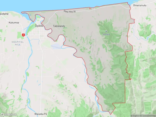
750 people live in Tirohanga, Opotiki, NZTirohanga Suburb Area Map (Polygon)
Tirohanga Introduction
Tirohanga (also known as Tirohanga) is a small rural community located in the Bay of Plenty region of New Zealand. It is situated on the eastern coast of the Bay of Plenty, approximately 20 kilometers south of Opotiki and 120 kilometers north of Tauranga. Tirohanga is known for its stunning natural surroundings, including lush forests, pristine beaches, and the Tirohanga Rock, a prominent landmark that offers panoramic views of the surrounding area. The community has a population of around 100 people and is home to a primary school, a church, and a small supermarket.Region
Major City
Suburb Name
TirohangaOther Name(s)
TablelandsTirohanga Area Map (Street)
Local Authority
Opotiki District (Maori Name: Ōpōtiki District)Full Address
Tirohanga, Opotiki District,Address Type
Locality in Town OpotikiTirohanga Suburb Map (Satellite)
Country
Main Region in AU
Bay of PlentyTirohanga Region Map
Coordinates
0,0 (latitude/longitude)Distances
The distance from Tirohanga, Opotiki, Opotiki District to NZ Top 10 Cities