Waipapa Area, Waipapa Postcode(0246) & Map in Waipapa
Waipapa Area, Waipapa Postcode(0246) & Map in Waipapa, Far North District,
Waipapa, Far North District,
Waipapa Area (estimated)
97.4 square kilometersWaipapa Population (estimated)
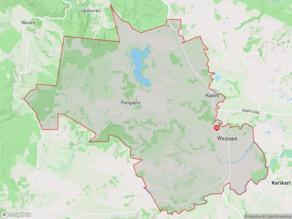
2851 people live in Waipapa, Kerikeri, NZWaipapa Suburb Area Map (Polygon)
Waipapa Introduction
Waipapa, Waipapa, Northland, NZ, is a small rural town located on the banks of the Waipapa River. It is known for its beautiful natural surroundings, including lush forests, waterfalls, and a stunning coastline. The town has a population of around 100 people and is a popular destination for tourists who enjoy hiking, fishing, and kayaking. The town also has a historic church and a community hall that hosts regular events and gatherings.Region
Major City
Suburb Name
WaipapaOther Name(s)
Kapiro, Pungaere, Te WhauWaipapa Area Map (Street)
Local Authority
Far North DistrictFull Address
Waipapa, Far North District,Address Type
Locality in Town WaipapaWaipapa Suburb Map (Satellite)
Country
Main Region in AU
NorthlandWaipapa Region Map
Coordinates
0,0 (latitude/longitude)Distances
The distance from Waipapa, Waipapa, Far North District to NZ Top 10 Cities