Trentham Area, Trentham Postcode(5018) & Map in Trentham
Trentham Area, Trentham Postcode(5018) & Map in Trentham, Upper Hutt City, New Zealand
Trentham, Upper Hutt City, New Zealand
Trentham Area (estimated)
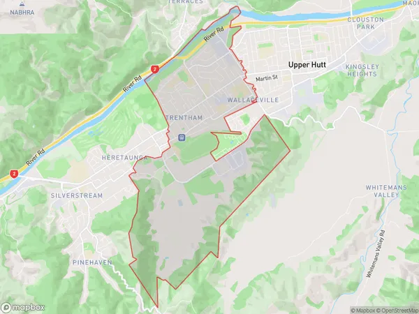
12.3 square kilometersTrentham Population (estimated)
10719 people live in Trentham, Upper Hutt, NZTrentham Suburb Area Map (Polygon)
Trentham Introduction
Trentham is a suburb of Upper Hutt, Wellington, New Zealand. It is located on the banks of the Trentham River and is known for its historic homes and gardens. The suburb has a strong community spirit and is home to a variety of shops, cafes, and recreational facilities. Trentham also has a popular golf course and is within easy reach of Wellington's city center.Region
Major City
Suburb Name
TrenthamOther Name(s)
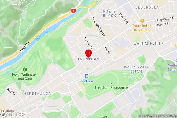
Rimutaka Prison, Trentham CampTrentham Area Map (Street)
Local Authority
Upper Hutt CityFull Address
Trentham, Upper Hutt City, New ZealandAddress Type
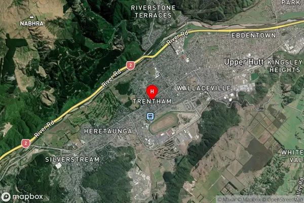
Suburb in City Upper HuttTrentham Suburb Map (Satellite)
Country
Main Region in AU
WellingtonTrentham Region Map

Coordinates
-41.1341841,175.0388329 (latitude/longitude)Distances
The distance from Trentham, Upper Hutt, Upper Hutt City to NZ Top 10 Cities