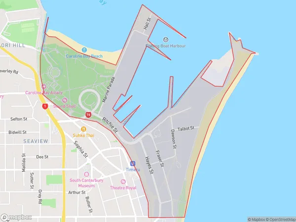
Timaru Port Area, Timaru Port Postcode(7910) & Map in Timaru Port
Timaru Port Area, Timaru Port Postcode(7910) & Map in Timaru Port, Timaru District,
Timaru Port, Timaru District,
Timaru Port Postcodes
Timaru Port Area (estimated)
1.4 square kilometersTimaru Port Population (estimated)
47 people live in Timaru Port, Timaru, NZTimaru Port Suburb Area Map (Polygon)

Timaru Port Introduction
Timaru Port is a significant commercial and industrial hub in New Zealand's South Island, serving as the country's largest exporter of frozen meat and a major exporter of wool and timber products. It is also home to a significant steel manufacturing plant. The port is situated on the southern coast of the island and is accessible by road, rail, and air.Region
Major City
Suburb Name
Timaru PortOther Name(s)
Maori Park, Timaru CentralTimaru Port Area Map (Street)
Local Authority
Timaru DistrictFull Address
Timaru Port, Timaru District,Address Type
Suburb in Town TimaruTimaru Port Suburb Map (Satellite)
Country
Main Region in AU
CanterburyTimaru Port Region Map
Coordinates
0,0 (latitude/longitude)Distances
The distance from Timaru Port, Timaru, Timaru District to NZ Top 10 Cities