Seadown Area, Seadown Postcode(7441) & Map in Seadown
Seadown Area, Seadown Postcode(7441) & Map in Seadown, Timaru District, New Zealand
Seadown, Timaru District, New Zealand
Seadown Area (estimated)
43.6 square kilometersSeadown Population (estimated)
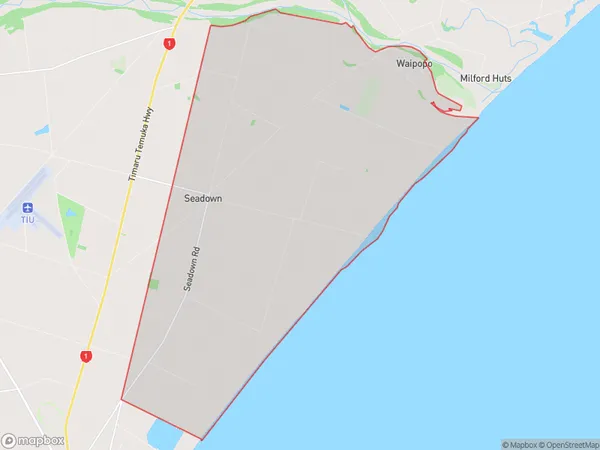
388 people live in Seadown, Canterbury, NZSeadown Suburb Area Map (Polygon)
Seadown Introduction
Seadown is a small rural community in Canterbury, New Zealand, located 12 kilometers south of Christchurch. It is known for its picturesque rural setting, with rolling hills, farms, and picturesque gardens. The area has a rich history, with several historic buildings and sites, including the Seadown railway station and the Seadown Hotel. Seadown is also home to a variety of wildlife, including birds, rabbits, and deer. The community has a strong sense of community and hosts several events and festivals throughout the year, including the Seadown Agricultural and Horticultural Show and the Seadown Christmas Festival.Region
Major City
Suburb Name
SeadownOther Name(s)
Seaforth, WaipopoSeadown Area Map (Street)
Local Authority
Timaru DistrictFull Address
Seadown, Timaru District, New ZealandAddress Type
Locality in Major Locality SeadownSeadown Suburb Map (Satellite)
Country
Main Region in AU
CanterburySeadown Region Map
Coordinates
-43.1314015,172.7501601 (latitude/longitude)Distances
The distance from Seadown, Seadown, Timaru District to NZ Top 10 Cities