Otaihanga Area, Otaihanga Postcode(5036) & Map in Otaihanga
Otaihanga Area, Otaihanga Postcode(5036) & Map in Otaihanga, Kapiti Coast District,
Otaihanga, Kapiti Coast District,
Otaihanga Postcodes
Otaihanga Area (estimated)
8.0 square kilometersOtaihanga Population (estimated)
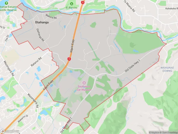
1030 people live in Otaihanga, Paraparaumu, NZOtaihanga Suburb Area Map (Polygon)
Otaihanga Introduction
Otaihanga is a suburb of Paraparaumu, Wellington, New Zealand. It is located on the southern coast of the Kapiti Coast, approximately 30 kilometers north of Wellington City. The suburb has a population of around 10,000 people and is known for its beautiful beaches, scenic views, and relaxed atmosphere. It is also home to the Otaihanga Airport, which provides regular flights to Wellington and other destinations in New Zealand.Region
Major City
Suburb Name
OtaihangaOther Name(s)
Waikanae ParkOtaihanga Area Map (Street)
Local Authority
Kapiti Coast DistrictFull Address
Otaihanga, Kapiti Coast District,Address Type
Suburb in Town ParaparaumuOtaihanga Suburb Map (Satellite)
Country
Main Region in AU
WellingtonOtaihanga Region Map
Coordinates
0,0 (latitude/longitude)Distances
The distance from Otaihanga, Paraparaumu, Kapiti Coast District to NZ Top 10 Cities