Ongaonga Area, Ongaonga Postcode(4171) & Map in Ongaonga
Ongaonga Area, Ongaonga Postcode(4171) & Map in Ongaonga, Central Hawke's Bay District, New Zealand
Ongaonga, Central Hawke's Bay District, New Zealand
Ongaonga Postcodes
Ongaonga Area (estimated)
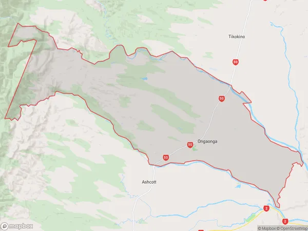
270.4 square kilometersOngaonga Population (estimated)
691 people live in Ongaonga, Hawke's Bay, NZOngaonga Suburb Area Map (Polygon)
Ongaonga Introduction
Ongaonga is a small rural community in Hawke's Bay, New Zealand, located on State Highway 2. It is known for its scenic views, historic buildings, and traditional Maori culture. The area has a population of around 100 people and is surrounded by farmland and native forests. Ongaonga is also home to the Ongaonga Power Station, which generates electricity for the region.Region
Major City
Suburb Name
OngaongaOther Name(s)
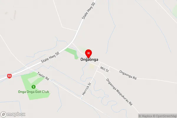
Blackburn, Onga Onga, Ruataniwha, SpringhillOngaonga Area Map (Street)
Local Authority
Central Hawke's Bay DistrictFull Address
Ongaonga, Central Hawke's Bay District, New ZealandAddress Type
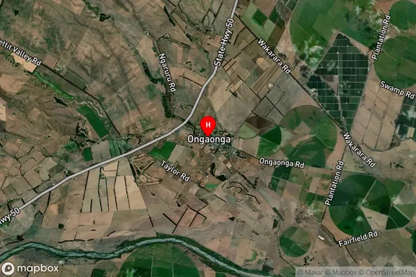
Locality in Major Locality OngaongaOngaonga Suburb Map (Satellite)
Country
Main Region in AU
Hawke's BayOngaonga Region Map

Coordinates
-39.9132921,176.4173428 (latitude/longitude)Distances
The distance from Ongaonga, Ongaonga, Central Hawke's Bay District to NZ Top 10 Cities