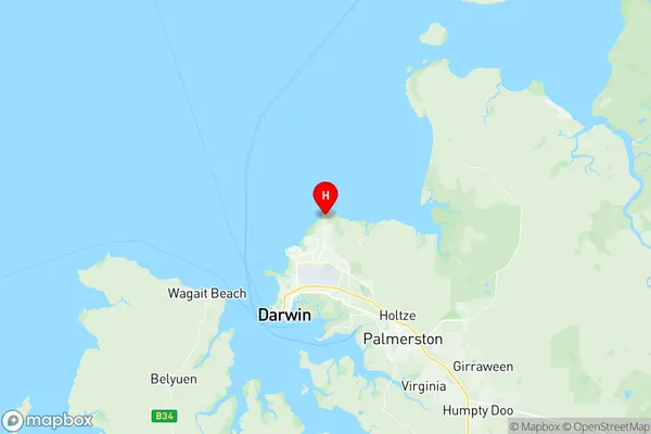
Lyons (NT) Suburbs & Region, Lyons (NT) Map & Postcodes
Lyons (NT) Suburbs & Region, Lyons (NT) Map & Postcodes in Lyons (NT), Darwin Suburbs, Darwin, NT, AU
Lyons (NT) Region
Region Name
Lyons (NT) (NT, AU)Lyons (NT) Area
7.04 square kilometers (7.04 ㎢)Lyons (NT) Introduction
Lyons (NT) is a locality in the Northern Territory of Australia. It is located about 165 kilometers southeast of Darwin in the Northern Territory's East Arnhem region. The population of Lyons at the 2011 census was 266. The town is situated on the Stuart Highway and is a popular stopping point for travelers heading to Katherine and the Northern Territory's Top End. The nearby Lyons River provides a source of water for the town and is a popular spot for fishing and swimming. The town has a primary school, a post office, a general store, and a community hall. The surrounding area is known for its scenic landscapes, including the Kakadu National Park and the Mary River National Park.Australia State
City or Big Region
Greater Capital City
Greater Darwin (7GDAR)District or Regional Area
Suburb Name
Lyons (NT) Region Map

Lyons (NT) Suburbs
Lyons (NT) full address
Lyons (NT), Darwin Suburbs, Darwin, Northern Territory, NT, Australia, SaCode: 701021021Country
Lyons (NT), Darwin Suburbs, Darwin, Northern Territory, NT, Australia, SaCode: 701021021
Lyons (NT) Suburbs & Region, Lyons (NT) Map & Postcodes has 0 areas or regions above, and there are 0 Lyons (NT) suburbs below. The sa2code for the Lyons (NT) region is 701021021. Its latitude and longitude coordinates are -12.3394,130.893. Lyons (NT) area belongs to Australia's greater capital city Greater Darwin.
