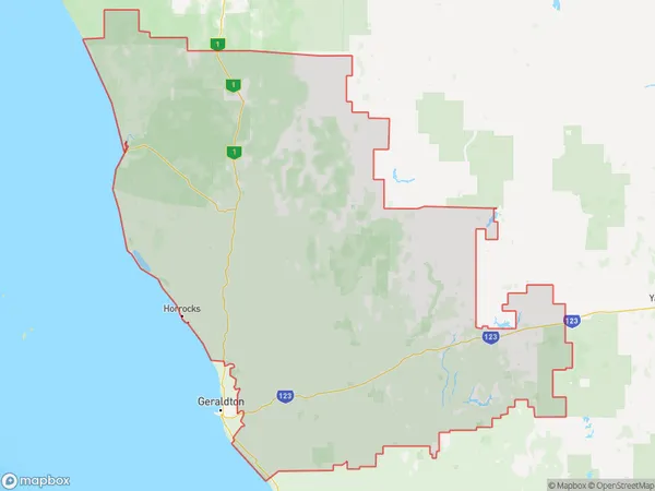
Northampton Mullewa Greenough Suburbs & Region, Northampton Mullewa Greenough Map & Postcodes
Northampton Mullewa Greenough Suburbs & Region, Northampton Mullewa Greenough Map & Postcodes in Northampton Mullewa Greenough, Mid West, Western Australia Outback, WA, AU
Northampton Mullewa Greenough Region
Region Name
Northampton Mullewa Greenough (WA, AU)Northampton Mullewa Greenough Area
26162 square kilometers (26,162 ㎢)Postal Codes
6528, 6532, 6535, 6536, 6628, and from 6630 to 6632 (In total, there are 8 postcodes in Northampton Mullewa Greenough.)Northampton Mullewa Greenough Introduction
Northampton Mullewa Greenough is a town in the Shire of Northampton, Western Australia, 261 km northeast of Perth, the state capital. It is named after the Greenough River, which flows through it. The town is a major agricultural center, with wheat, sheep, and cattle being the main crops. The town has a population of around 2,000 people and is home to the Northampton Football Club and the Northampton Golf Club. The town also has a hospital, a primary school, a post office, and a variety of shops and services. The Greenough River flows through the town, providing water for irrigation and domestic use. The river is also a popular spot for fishing and swimming.Australia State
City or Big Region
Greater Capital City
Rest of WA (5RWAU)District or Regional Area
Suburb Name
Northampton Mullewa Greenough Region Map

Northampton Mullewa Greenough Postcodes / Zip Codes
Northampton Mullewa Greenough Suburbs
Northampton Mullewa Greenough full address
Northampton Mullewa Greenough, Mid West, Western Australia Outback, Western Australia, WA, Australia, SaCode: 511041292Country
Northampton Mullewa Greenough, Mid West, Western Australia Outback, Western Australia, WA, Australia, SaCode: 511041292
Northampton Mullewa Greenough Suburbs & Region, Northampton Mullewa Greenough Map & Postcodes has 0 areas or regions above, and there are 68 Northampton Mullewa Greenough suburbs below. The sa2code for the Northampton Mullewa Greenough region is 511041292. Its latitude and longitude coordinates are -28.1541,115.684. Northampton Mullewa Greenough area belongs to Australia's greater capital city Rest of WA.
Northampton Mullewa Greenough Suburbs & Localities
1. Burma Road
2. Dindiloa
5. Northern Gully
6. Rockwell
7. South Yuna
8. Wicherina South
9. Walkaway
13. Gregory
14. Yallabatharra
15. Zuytdorp
16. Devils Creek
17. Mullewa
18. Nunierra
19. Tenindewa
22. Coolcalalaya
23. Dartmoor
24. East Yuna
25. Ellendale
26. Greenough
27. Moonyoonooka
28. Mount Erin
29. Narra Tarra
31. North Eradu
32. Sandsprings
33. West Binnu
34. Wicherina
36. Ogilvie
37. Sandy Gully
38. Kalbarri National Park
39. Bootenal
41. Georgina
42. Howatharra
44. Minnenooka
46. Wandana
48. East Bowes
49. Northampton
50. Mount Hill
51. South Greenough
52. East Chapman
53. East Nabawa
55. Eradu South
56. Eurardy
57. Kojarena
59. Naraling
60. Tibradden
61. Valentine
62. Horrocks
63. Kalbarri
65. West Casuarinas
66. Wongoondy
68. Ambania
