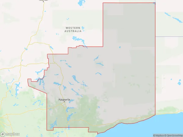
Goldfields Suburbs & Region, Goldfields Map & Postcodes
Goldfields Suburbs & Region, Goldfields Map & Postcodes in Goldfields, Western Australia Outback (South), WA, AU
Goldfields Region
Region Name
Goldfields (WA, AU)Goldfields Area
714525 square kilometers (714,525 ㎢)Goldfields Introduction
The Goldfields-Esperance region of Western Australia is a remote and arid area known for its gold mining and mining heritage. It is located in the South West Botanical Province and includes the towns of Kalgoorlie, Boulder, and Coolgardie. The region has a rich history of gold mining, dating back to the 1890s, and is still a significant source of gold production today. The area is also home to many historic mining sites, including the Super Pit and the Eureka Stockade. The Goldfields-Esperance region is a popular tourist destination, with visitors coming to explore the region's natural beauty, including the Great Western Woodlands and the Kalgoorlie-Boulder Desert. The region is also home to a number of cultural and recreational attractions, including the Goldfields Museum and the Esperance Museum.Australia State
City or Big Region
Greater Capital City
Rest of WA (5RWAU)District or Regional Area
Goldfields Suburbs
Goldfields full address
Goldfields, Western Australia Outback (South), Western Australia, WA, Australia, SaCode: 51103Country
Goldfields, Western Australia Outback (South), Western Australia, WA, Australia, SaCode: 51103
Goldfields Suburbs & Region, Goldfields Map & Postcodes has 0 areas or regions above, and there are 0 Goldfields suburbs below. The sa3code for the Goldfields region is 51103. Goldfields area belongs to Australia's greater capital city Rest of WA.
