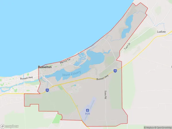
Busselton East Suburbs & Region, Busselton East Map & Postcodes
Busselton East Suburbs & Region, Busselton East Map & Postcodes in Busselton East, Augusta Margaret River Busselton, Bunbury, WA, AU
Busselton East Region
Region Name
Busselton East (WA, AU)Busselton East Area
81.96 square kilometers (81.96 ㎢)Busselton East Introduction
Busselton East is a suburb of the City of Bunbury in Western Australia, located 21 kilometers south of the state capital, Perth. It is part of the Southwest Region and is named after the Busselton River, which flows through the area. The suburb has a population of around 1,500 people and is known for its beautiful beaches, lush gardens, and tranquil atmosphere. It is also home to several popular attractions, including the Busselton Jetty, a historic timber pier that extends into the Indian Ocean, and the Busselton Regional Museum, which showcases the region's rich history and culture.Australia State
City or Big Region
Greater Capital City
Rest of WA (5RWAU)District or Regional Area
Suburb Name
Busselton East Suburbs
Busselton East full address
Busselton East, Augusta Margaret River Busselton, Bunbury, Western Australia, WA, Australia, SaCode: 501011293Country
Busselton East, Augusta Margaret River Busselton, Bunbury, Western Australia, WA, Australia, SaCode: 501011293
Busselton East Suburbs & Region, Busselton East Map & Postcodes has 0 areas or regions above, and there are 0 Busselton East suburbs below. The sa2code for the Busselton East region is 501011293. Busselton East area belongs to Australia's greater capital city Rest of WA.
