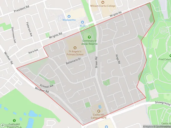
Castle Hill West Suburbs & Region, Castle Hill West Map & Postcodes
Castle Hill West Suburbs & Region, Castle Hill West Map & Postcodes in Castle Hill West, Baulkham Hills, Sydney Baulkham Hills and Hawkesbury, NSW, AU
Castle Hill West Region
Region Name
Castle Hill West (NSW, AU)Castle Hill West Area
1.64 square kilometers (1.64 ㎢)Castle Hill West Introduction
Castle Hill West, Sydney Baulkham Hills and Hawkesbury is a suburb in the Hills District of Sydney, in New South Wales, Australia. It is located 32 kilometres west of the Sydney central business district and is part of the Greater Western Sydney region. The suburb is named after the Castle Hill convict settlement and is home to a large number of historic buildings and sites. The area is known for its scenic bushland and parks, including the Castle Hill National Park and the Hawkesbury River. It is also home to a number of major shopping centres and commercial precincts, including the Castle Hill Shopping Centre and the Baulkham Hills Town Centre.Australia State
City or Big Region
Greater Capital City
Greater Sydney (1GSYD)District or Regional Area
Suburb Name
Castle Hill West Suburbs
Castle Hill West full address
Castle Hill West, Baulkham Hills, Sydney Baulkham Hills and Hawkesbury, New South Wales, NSW, Australia, SaCode: 115011557Country
Castle Hill West, Baulkham Hills, Sydney Baulkham Hills and Hawkesbury, New South Wales, NSW, Australia, SaCode: 115011557
Castle Hill West Suburbs & Region, Castle Hill West Map & Postcodes has 0 areas or regions above, and there are 0 Castle Hill West suburbs below. The sa2code for the Castle Hill West region is 115011557. Castle Hill West area belongs to Australia's greater capital city Greater Sydney.
