Forster-Tuncurry Region Suburbs & Region, Forster-Tuncurry Region Map & Postcodes
Forster-Tuncurry Region Suburbs & Region, Forster-Tuncurry Region Map & Postcodes in Forster-Tuncurry Region, Great Lakes, Mid North Coast, NSW, AU
Forster-Tuncurry Region Region
Region Name
Forster-Tuncurry Region (NSW, AU)Forster-Tuncurry Region Area
749.48 square kilometers (749.48 ㎢)Postal Codes
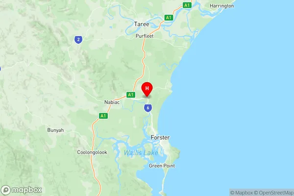
2312, 2423, 2428, and 2430 (In total, there are 4 postcodes in Forster-Tuncurry Region.)Forster-Tuncurry Region Suburb Area Map (Polygon)

Forster-Tuncurry Region Introduction
The Forster-Tuncurry Region is a local government area in the Mid North Coast region of New South Wales, Australia. It is located approximately 450 kilometers north of Sydney and covers an area of 1,167 square kilometers. The region is home to the towns of Forster, Tuncurry, and Taree, as well as a number of smaller communities and rural areas. The region is known for its beautiful beaches, including the famous Forster-Tuncurry Beach, which is a popular destination for tourists and locals alike. The area is also home to a number of national parks and reserves, including the Wallamba National Park and the Manning River National Park. The region is a major producer of agricultural products, including cotton, wheat, and beef. The Forster-Tuncurry Region has a population of approximately 21,000 people and is governed by a council with nine members. The region is located in the state's mid-north coast region, approximately 450 kilometers north of Sydney. The region is home to the towns of Forster, Tuncurry, and Taree, as well as a number of smaller communities and rural areas. The region is known for its beautiful beaches, including the famous Forster-Tuncurry Beach, which is a popular destination for tourists and locals alike. The area is also home to a number of national parks and reserves, including the WallAustralia State
City or Big Region
Greater Capital City
Rest of NSW (1RNSW)District or Regional Area
Suburb Name
Forster-Tuncurry Region Region Map
Forster-Tuncurry Region Postcodes / Zip Codes
Forster-Tuncurry Region Suburbs
Forster-Tuncurry Region full address
Forster-Tuncurry Region, Great Lakes, Mid North Coast, New South Wales, NSW, Australia, SaCode: 108011153Country
Forster-Tuncurry Region, Great Lakes, Mid North Coast, New South Wales, NSW, Australia, SaCode: 108011153
Forster-Tuncurry Region Suburbs & Region, Forster-Tuncurry Region Map & Postcodes has 0 areas or regions above, and there are 26 Forster-Tuncurry Region suburbs below. The sa2code for the Forster-Tuncurry Region region is 108011153. Its latitude and longitude coordinates are -32.0885,152.476. Forster-Tuncurry Region area belongs to Australia's greater capital city Rest of NSW.
Forster-Tuncurry Region Suburbs & Localities
1. Minimbah
2. Nabiac
3. Wootton
4. Coomba Park
5. Elizabeth Beach
6. Pacific Palms
7. Whoota
8. Failford
9. Willina
10. Blueys Beach
11. Boomerang Beach
12. Charlotte Bay
13. Sandbar
14. Smiths Lake
15. Wallis Lake
16. Coolongolook
17. Seal Rocks
18. Shallow Bay
19. Tarbuck Bay
20. Tiona
21. Bungwahl
22. Wallingat
23. Booti Booti
24. Coomba Bay
25. Darawank
26. Wallingat