ZipCode 6107 Areas, AU PostCode 6107 Suburbs
Postcode 6107 Suburbs, ZipCode 6107 Areas & Regions in Canning,WA Australia
There are at least 7 AU suburbs share the same AU PostCode 6107 Suburbs in Canning, Gosnells, Kalamunda.
Postal Code 6107 Regions
The Australia postcode 6107 regions include Cannington - Queens Park, Bentley - Wilson - St James, Beckenham - Kenwick - Langford, Forrestfield - Wattle Grove in the areas of Canning, Gosnells, Kalamunda, Cannington - Queens Park, These postcode areas are all located in the state Western Australia, WA.Australia postcode 6107 is located in the state of Western Australia, in the City of Kalamunda. It covers an area of approximately 11.2 square kilometers and has a population of approximately 10,017 people. The postcode includes the suburbs of Kalamunda, Lesmurdie, and Maida Vale.
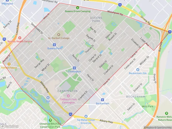
ZipCode 6107 Areas Map for Cannington - Queens Park
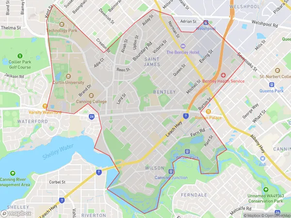
AU PostCode 6107 Suburbs Map for Bentley - Wilson - St James
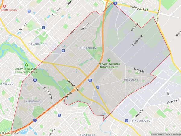
Postal Code 6107 Regions Map for Beckenham - Kenwick - Langford
AU PostCode 6107 Suburbs
AU PostCode 6107 suburbs contain Cannington, East Cannington, Wilson, Beckenham, Kenwick, Queens Park, Wattle Grove, you can check the below link to see the 7 suburbs detailed information.
AU PostCode 6107 Suburbs Map
ZipCode 6107 Areas
1. Cannington
2. East Cannington
3. Wilson
4. Beckenham
5. Kenwick
6. Queens Park
7. Wattle Grove