Werrington Downs Area, Werrington Downs Postcode(2747) & Map in Werrington Downs, Sydney - Outer West and Blue Mountains, NSW
Werrington Downs Area, Werrington Downs Postcode(2747) & Map in Werrington Downs, Sydney - Outer West and Blue Mountains, NSW, AU, Postcode: 2747
Werrington Downs, Cambridge Park, Penrith, Sydney - Outer West and Blue Mountains, New South Wales, Australia, 2747
Werrington Downs Postcode
Area Name
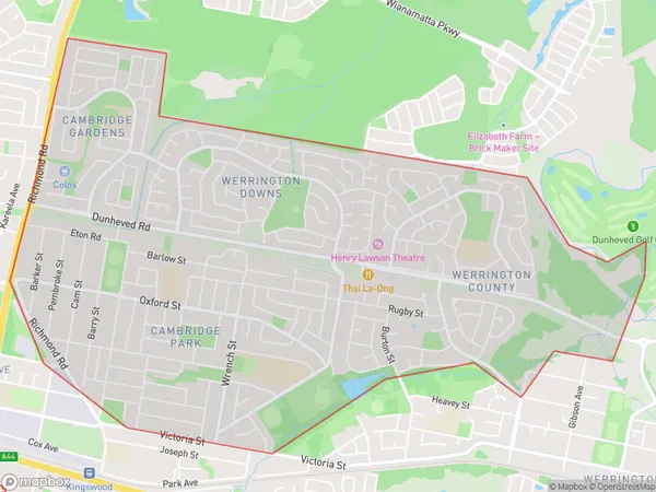
Werrington DownsWerrington Downs Suburb Area Map (Polygon)
Werrington Downs Introduction
Werrington Downs is a suburb in the local government area of the City of Canada Bay, located in Sydney, New South Wales, Australia. It is situated 35 kilometres west of the Sydney central business district and is part of the Greater Western Sydney region. Werrington Downs is named after the historic Werrington Estate, which was once the home of the wealthy Williams family. The suburb has a rich history and is known for its beautiful gardens and parks. It is also home to a number of important historical sites, including the Werrington County Hospital and the Werrington railway station.State Name
City or Big Region
District or Regional Area
Suburb Name
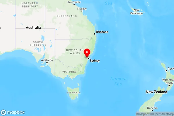
Werrington Downs Region Map
Country
Main Region in AU
R1Coordinates
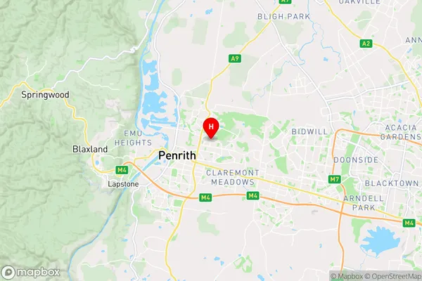
-33.7391,150.7273 (latitude/longitude)Werrington Downs Area Map (Street)
Longitude
150.739398Latitude
-33.722323Werrington Downs Elevation
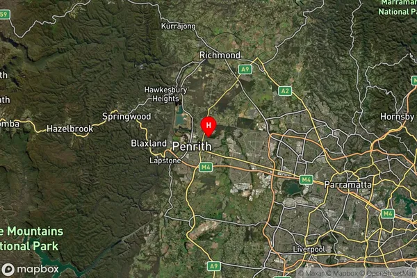
about 44.75 meters height above sea level (Altitude)Werrington Downs Suburb Map (Satellite)
Distances
The distance from Werrington Downs, Sydney - Outer West and Blue Mountains, NSW to AU Greater Capital CitiesSA1 Code 2011
12403145726SA1 Code 2016
12403145726SA2 Code
124031457SA3 Code
12403SA4 Code
124RA 2011
1RA 2016
1MMM 2015
1MMM 2019
1Charge Zone
N1LGA Region
PenrithLGA Code
16350Electorate
Lindsay