Luddenham Area, Luddenham Postcode(2745) & Map in Luddenham, Sydney - South West, NSW
Luddenham Area, Luddenham Postcode(2745) & Map in Luddenham, Sydney - South West, NSW, AU, Postcode: 2745
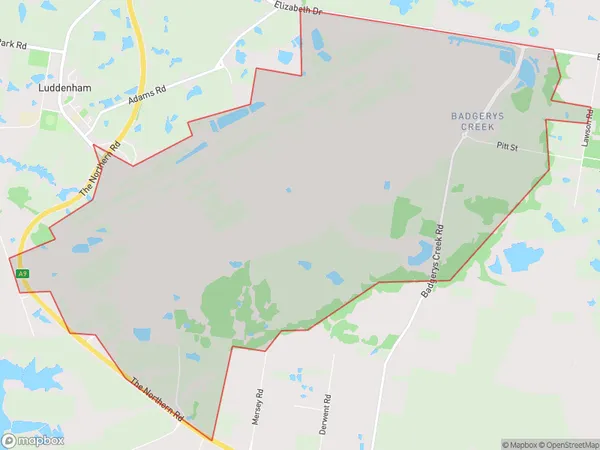
Luddenham, Badgerys Creek, Bringelly - Green Valley, Sydney - South West, New South Wales, Australia, 2745
Luddenham Postcode
Area Name
LuddenhamLuddenham Suburb Area Map (Polygon)
Luddenham Introduction
Luddenham is a suburb in Sydney's south-west, 12 kilometres from the city centre. It is part of the City of Canada Bay and has a population of around 11,000 people. The suburb has a mix of residential and commercial properties and is known for its well-maintained parks and recreational facilities. Luddenham is also home to a number of major businesses, including a shopping centre and a technology park.State Name
City or Big Region
District or Regional Area
Suburb Name
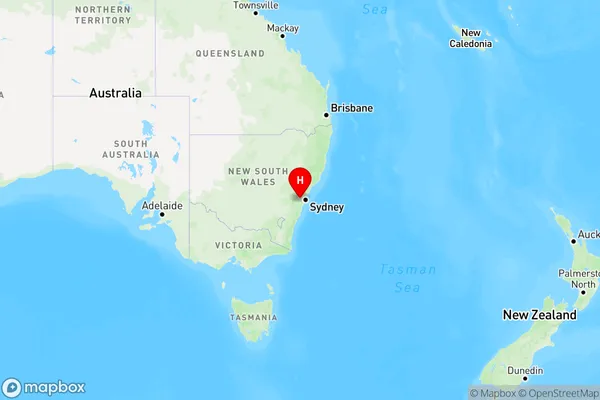
Luddenham Region Map
Country
Main Region in AU
R1Coordinates
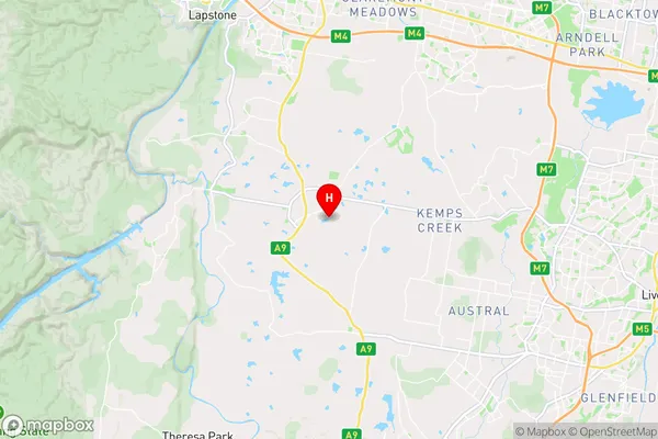
-33.8807,150.7146 (latitude/longitude)Luddenham Area Map (Street)
Longitude
150.671487Latitude
-33.871341Luddenham Elevation
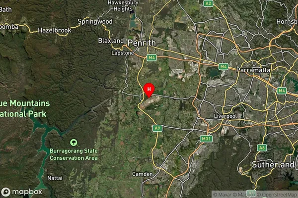
about 82.10 meters height above sea level (Altitude)Luddenham Suburb Map (Satellite)
Distances
The distance from Luddenham, Sydney - South West, NSW to AU Greater Capital CitiesSA1 Code 2011
12403146309SA1 Code 2016
12701159201SA2 Code
127011592SA3 Code
12701SA4 Code
127RA 2011
2RA 2016
2MMM 2015
2MMM 2019
2Charge Zone
N1LGA Region
PenrithLGA Code
16350Electorate
Lindsay