Glenmore Park Area, Glenmore Park Postcode(2745) & Map in Glenmore Park, Sydney - Outer West and Blue Mountains, NSW
Glenmore Park Area, Glenmore Park Postcode(2745) & Map in Glenmore Park, Sydney - Outer West and Blue Mountains, NSW, AU, Postcode: 2745
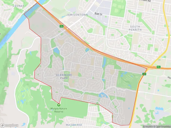
Glenmore Park, Glenmore Park - Regentville, Penrith, Sydney - Outer West and Blue Mountains, New South Wales, Australia, 2745
Glenmore Park Postcode
Area Name
Glenmore ParkGlenmore Park Suburb Area Map (Polygon)
Glenmore Park Introduction
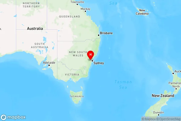
Glenmore Park is a suburb in the local government area of the City of Hawkesbury, located in the Western Suburbs of Sydney, New South Wales, Australia. It is named after the Glenmore Estate, which was once the property of the wealthy Macquarie family. The suburb is located 46 kilometers west of Sydney's central business district and is part of the Greater Western Sydney region.State Name
City or Big Region
District or Regional Area
Suburb Name
Glenmore Park Region Map
Country
Main Region in AU
R1Coordinates
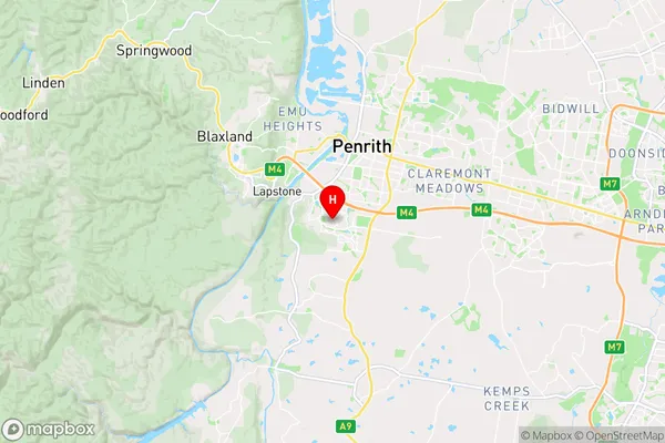
-33.79,150.676 (latitude/longitude)Glenmore Park Area Map (Street)
Longitude
150.671487Latitude
-33.871341Glenmore Park Elevation
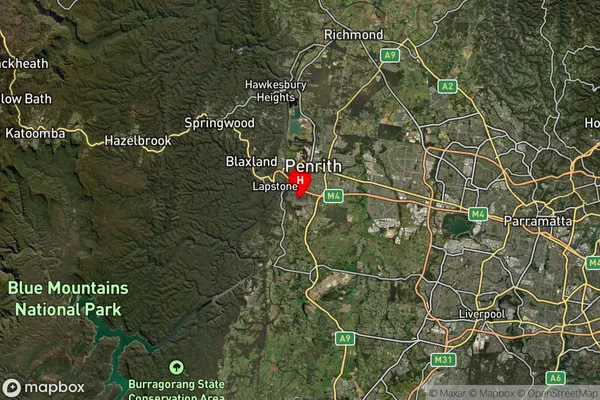
about 82.10 meters height above sea level (Altitude)Glenmore Park Suburb Map (Satellite)
Distances
The distance from Glenmore Park, Sydney - Outer West and Blue Mountains, NSW to AU Greater Capital CitiesSA1 Code 2011
12403146034SA1 Code 2016
12403146034SA2 Code
124031460SA3 Code
12403SA4 Code
124RA 2011
1RA 2016
1MMM 2015
1MMM 2019
1Charge Zone
N1LGA Region
PenrithLGA Code
16350Electorate
Lindsay