Wentworth Falls Area, Wentworth Falls Postcode(2782) & Map in Wentworth Falls, Sydney - Outer West and Blue Mountains, NSW
Wentworth Falls Area, Wentworth Falls Postcode(2782) & Map in Wentworth Falls, Sydney - Outer West and Blue Mountains, NSW, AU, Postcode: 2782
Wentworth Falls, Wentworth Falls, Blue Mountains, Sydney - Outer West and Blue Mountains, New South Wales, Australia, 2782
Wentworth Falls Postcode
Area Name
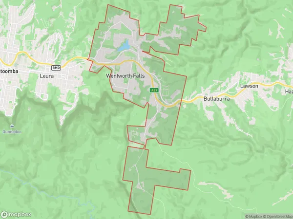
Wentworth FallsWentworth Falls Suburb Area Map (Polygon)
Wentworth Falls Introduction
Wentworth Falls is a picturesque waterfall located in the Blue Mountains National Park in Sydney, Australia. It is a popular destination for hikers and nature enthusiasts, with a walking track that leads to the base of the falls. The waterfall cascades down a rocky cliff face and is surrounded by lush vegetation.State Name
City or Big Region
District or Regional Area
Suburb Name
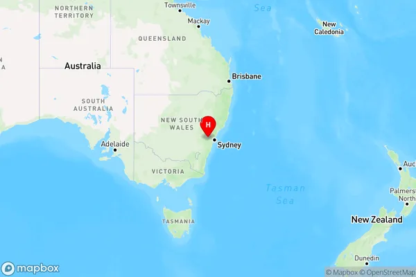
Wentworth Falls Region Map
Country
Main Region in AU
R3Coordinates
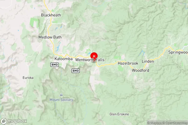
-33.7206345,150.3790612 (latitude/longitude)Wentworth Falls Area Map (Street)
Longitude
150.366015Latitude
-33.704416Wentworth Falls Elevation
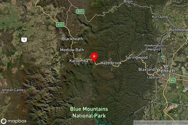
about 899.06 meters height above sea level (Altitude)Wentworth Falls Suburb Map (Satellite)
Distances
The distance from Wentworth Falls, Sydney - Outer West and Blue Mountains, NSW to AU Greater Capital CitiesSA1 Code 2011
12401145511SA1 Code 2016
12401145511SA2 Code
124011455SA3 Code
12401SA4 Code
124RA 2011
1RA 2016
1MMM 2015
1MMM 2019
1Charge Zone
N1LGA Region
Blue MountainsLGA Code
10900Electorate
Macquarie