Yosemite Area, Yosemite Postcode(2780) & Map in Yosemite, Sydney - Outer West and Blue Mountains, NSW
Yosemite Area, Yosemite Postcode(2780) & Map in Yosemite, Sydney - Outer West and Blue Mountains, NSW, AU, Postcode: 2780
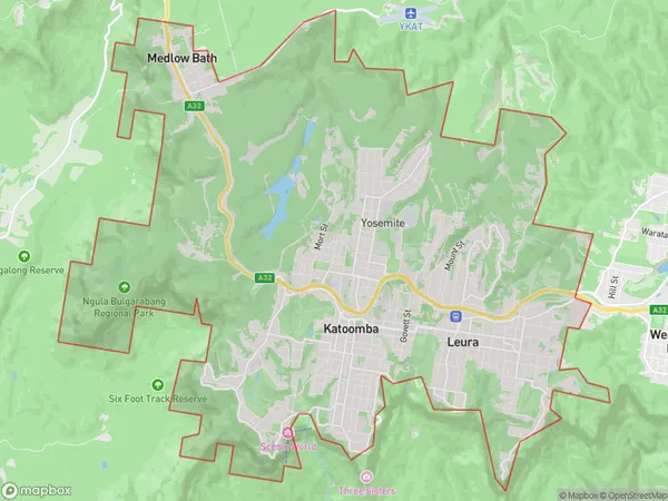
Yosemite, Katoomba - Leura, Blue Mountains, Sydney - Outer West and Blue Mountains, New South Wales, Australia, 2780
Yosemite Postcode
Area Name
YosemiteYosemite Suburb Area Map (Polygon)
Yosemite Introduction
Yosemite is a suburb in Sydney's outer west, located 37 kilometres from the city centre. It is known for its stunning natural beauty, including the iconic Yosemite Falls. The area is popular with outdoor enthusiasts, with many hiking and cycling trails. It is also home to a number of cultural institutions, including the Western Sydney Museum and the Blue Mountains Botanic Garden.State Name
City or Big Region
District or Regional Area
Suburb Name
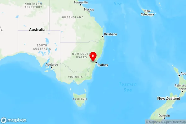
Yosemite Region Map
Country
Main Region in AU
R3Coordinates
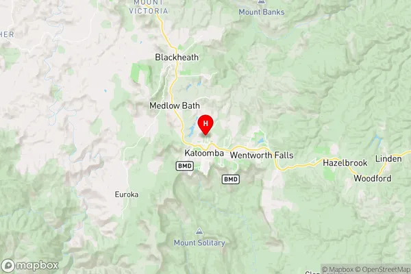
-33.7004567,150.3135547 (latitude/longitude)Yosemite Area Map (Street)
Longitude
150.435639Latitude
-33.832923Yosemite Elevation
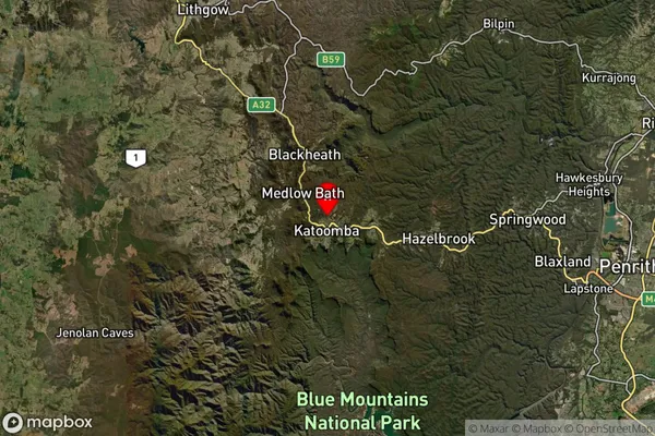
about 564.12 meters height above sea level (Altitude)Yosemite Suburb Map (Satellite)
Distances
The distance from Yosemite, Sydney - Outer West and Blue Mountains, NSW to AU Greater Capital CitiesSA1 Code 2011
12401145214SA1 Code 2016
12401145214SA2 Code
124011452SA3 Code
12401SA4 Code
124RA 2011
1RA 2016
1MMM 2015
1MMM 2019
1Charge Zone
N1LGA Region
Blue MountainsLGA Code
10900Electorate
Macquarie