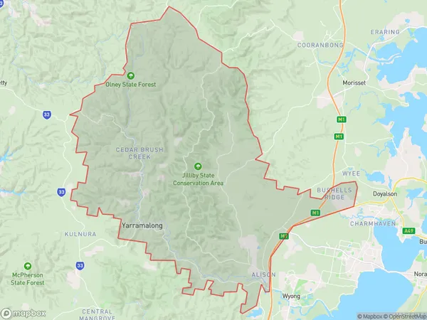
Lemon Tree Area, Lemon Tree Postcode(2259) & Map in Lemon Tree, Central Coast, NSW
Lemon Tree Area, Lemon Tree Postcode(2259) & Map in Lemon Tree, Central Coast, NSW, AU, Postcode: 2259
Lemon Tree, Jilliby - Yarramalong, Wyong, Central Coast, New South Wales, Australia, 2259
Lemon Tree Postcode
Area Name
Lemon TreeLemon Tree Suburb Area Map (Polygon)

Lemon Tree Introduction
Lemon Tree, Central Coast, NSW, AU, is a popular tourist destination known for its scenic views, lemon orchards, and fresh lemon products. It is located in the heart of the Central Coast region and offers a peaceful and relaxing environment for visitors. The tree-lined streets, charming cafes, and local markets make it a great place to explore and enjoy the natural beauty of the area.State Name
City or Big Region
District or Regional Area
Suburb Name
Lemon Tree Region Map

Country
Main Region in AU
R2Coordinates
-33.148,151.368 (latitude/longitude)Lemon Tree Area Map (Street)

Longitude
151.377213Latitude
-33.208801Lemon Tree Elevation
about 20.95 meters height above sea level (Altitude)Lemon Tree Suburb Map (Satellite)

Distances
The distance from Lemon Tree, Central Coast, NSW to AU Greater Capital CitiesSA1 Code 2011
10202104910SA1 Code 2016
10202104910SA2 Code
102021049SA3 Code
10202SA4 Code
102RA 2011
2RA 2016
2MMM 2015
2MMM 2019
2Charge Zone
N1LGA Region
Central CoastLGA Code
11650Electorate
Shortland