Richards Area, Richards Postcode(2765) & Map in Richards, Sydney - Outer West and Blue Mountains, NSW
Richards Area, Richards Postcode(2765) & Map in Richards, Sydney - Outer West and Blue Mountains, NSW, AU, Postcode: 2765
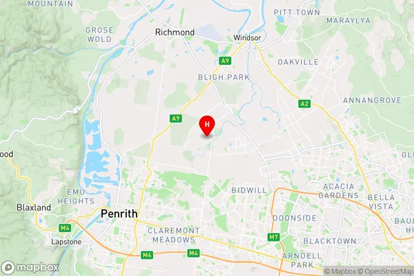
Richards, Yarramundi - Londonderry, Richmond - Windsor, Sydney - Outer West and Blue Mountains, New South Wales, Australia, 2765
Richards Postcode
Area Name
RichardsRichards Suburb Area Map (Polygon)

Richards Introduction
Sydney - Outer West and Blue Mountains, NSW, AU is a region in Australia that includes the suburbs of Blacktown, Penrith, and Blue Mountains. It is known for its natural beauty, including the Blue Mountains National Park and the Nepean River. The area has a population of over 1.5 million people and is home to many cultural and recreational attractions, including the Sydney Opera House and the Sydney Harbour Bridge.State Name
City or Big Region
District or Regional Area
Suburb Name
Richards Region Map

Country
Main Region in AU
R1Coordinates
-33.6886,150.78165 (latitude/longitude)Richards Area Map (Street)
Longitude
150.79576Latitude
-33.672237Richards Suburb Map (Satellite)

Distances
The distance from Richards, Sydney - Outer West and Blue Mountains, NSW to AU Greater Capital CitiesSA1 Code 2011
12404146803SA1 Code 2016
12404146803SA2 Code
124041468SA3 Code
12404SA4 Code
124RA 2011
1RA 2016
1MMM 2015
1MMM 2019
1Charge Zone
N1LGA Region
BlacktownLGA Code
10750Electorate
Mitchell