Wallington Area, Wallington Postcode(3222) & Map in Wallington, Geelong, VIC
Wallington Area, Wallington Postcode(3222) & Map in Wallington, Geelong, VIC, AU, Postcode: 3222
Wallington, Ocean Grove - Barwon Heads, Surf Coast - Bellarine Peninsula, Geelong, Victoria, Australia, 3222
Wallington Postcode
Area Name
WallingtonWallington Suburb Area Map (Polygon)
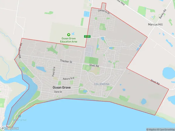
Wallington Introduction
Wallington is a suburb of Geelong, Victoria, Australia, located 11 km south-west of the city center. It is known for its natural beauty, including the Barwon River and the You Yangs Regional Park. Wallington has a population of approximately 10,000 people and is home to a variety of shops, restaurants, and schools.State Name
City or Big Region
District or Regional Area
Suburb Name
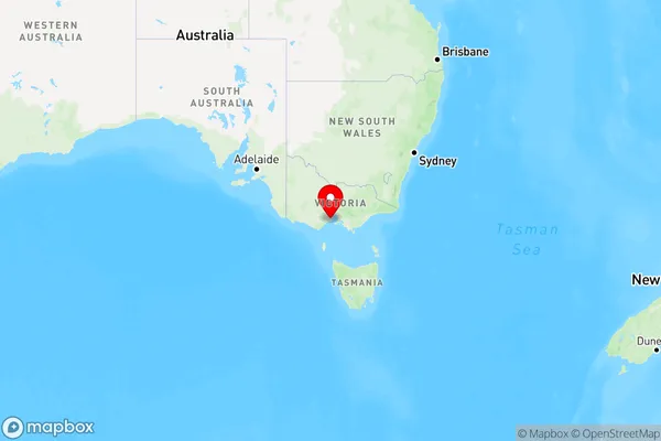
Wallington Region Map
Country
Main Region in AU
R2Coordinates
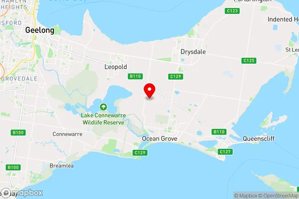
-38.2247,144.511 (latitude/longitude)Wallington Area Map (Street)
Longitude
144.5118946Latitude
-38.22638039Wallington Suburb Map (Satellite)

Distances
The distance from Wallington, Geelong, VIC to AU Greater Capital CitiesSA1 Code 2011
20303105040SA1 Code 2016
20303105040SA2 Code
203031050SA3 Code
20303SA4 Code
203RA 2011
2RA 2016
2MMM 2015
2MMM 2019
2Charge Zone
V2LGA Region
QueenscliffeLGA Code
26080Electorate
Corangamite