Olney Area, Olney Postcode(2325) & Map in Olney, Hunter Valley exc Newcastle, NSW
Olney Area, Olney Postcode(2325) & Map in Olney, Hunter Valley exc Newcastle, NSW, AU, Postcode: 2325
Olney, Cessnock Region, Lower Hunter, Hunter Valley exc Newcastle, New South Wales, Australia, 2325
Olney Postcode
Area Name
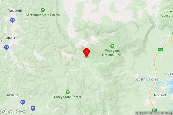
OlneyOlney Suburb Area Map (Polygon)

Olney Introduction
Olney is a small town in the Hunter Valley region of New South Wales, Australia, located approximately 150 kilometers north of Sydney. It is known for its wine production, particularly for its Semillon and Shiraz varieties. The town has a population of around 5,000 people and is home to several wineries, including the award-winning Tyrrell's Winery. Olney is also a popular tourist destination, with many visitors coming to enjoy the scenic countryside, the local produce, and the wine tastings.State Name
City or Big Region
District or Regional Area
Suburb Name
Olney Region Map
Country
Main Region in AU
R3Coordinates
-33.031569,151.3123522 (latitude/longitude)Olney Area Map (Street)
Longitude
151.3131147Latitude
-33.03362627Olney Elevation
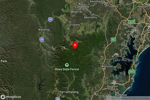
about 256.61 meters height above sea level (Altitude)Olney Suburb Map (Satellite)
Distances
The distance from Olney, Hunter Valley exc Newcastle, NSW to AU Greater Capital CitiesSA1 Code 2011
10601110916SA1 Code 2016
10601110916SA2 Code
106011109SA3 Code
10601SA4 Code
106RA 2011
2RA 2016
2MMM 2015
5MMM 2019
5Charge Zone
N2LGA Region
CessnockLGA Code
11720Electorate
Hunter