West Hindmarsh Area, West Hindmarsh Postcode(5007) & Map in West Hindmarsh, Adelaide - West, SA
West Hindmarsh Area, West Hindmarsh Postcode(5007) & Map in West Hindmarsh, Adelaide - West, SA, AU, Postcode: 5007
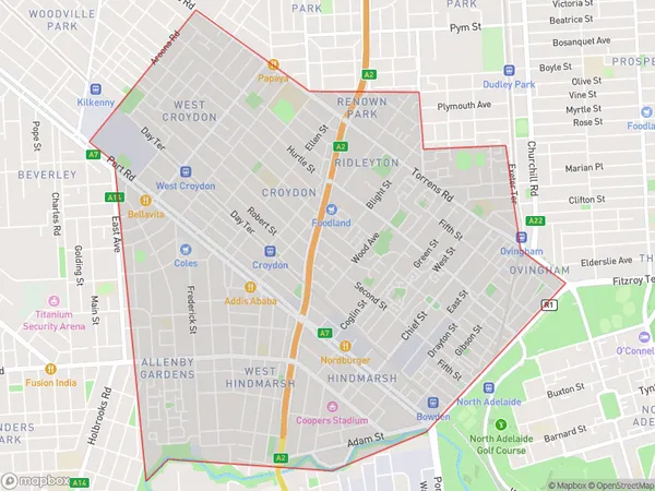
West Hindmarsh, Hindmarsh - Brompton, Charles Sturt, Adelaide - West, South Australia, Australia, 5007
West Hindmarsh Postcode
Area Name
West HindmarshWest Hindmarsh Suburb Area Map (Polygon)
West Hindmarsh Introduction
West Hindmarsh is a suburb of Adelaide, South Australia, located 5 km west of the CBD. It is known for its diverse population, including a large number of immigrants and refugees. The suburb has a mix of residential and commercial areas, with a number of parks and recreational facilities.State Name
City or Big Region
District or Regional Area
Suburb Name
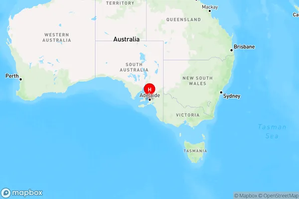
West Hindmarsh Region Map
Country
Main Region in AU
R2Coordinates
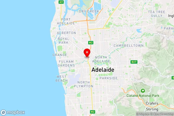
-34.9054239,138.5625029 (latitude/longitude)West Hindmarsh Area Map (Street)
Longitude
138.56787Latitude
-34.903259West Hindmarsh Elevation
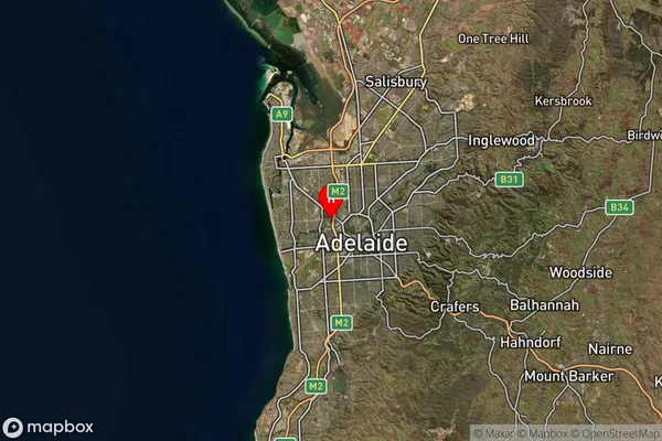
about 16.25 meters height above sea level (Altitude)West Hindmarsh Suburb Map (Satellite)
Distances
The distance from West Hindmarsh, Adelaide - West, SA to AU Greater Capital CitiesSA1 Code 2011
40401109333SA1 Code 2016
40401109333SA2 Code
404011093SA3 Code
40401SA4 Code
404RA 2011
1RA 2016
1MMM 2015
1MMM 2019
1Charge Zone
S1LGA Region
ProspectLGA Code
46510Electorate
Adelaide