Rototuna Suburbs & Region, Rototuna Map & Postcodes in Rototuna, Hamilton City, Waikato
Rototuna Postcodes, Rototuna ZipCodes, Rototuna , Rototuna Waikato, Rototuna Suburbs, Rototuna Region, Rototuna Map, Rototuna Area
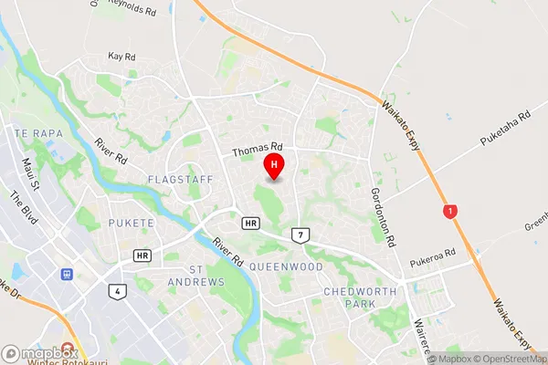
Rototuna Region (North Huntington Region)
Rototuna Suburbs
Rototuna is a suburb place type in Hamilton City, Waikato, NZ. It contains 0 suburbs or localities.Rototuna Postcodes
Rototuna Region Map
Rototuna Introduction
Rototuna is a small town in Waikato, New Zealand, with a population of around 5,000 people. It is well known for its historic buildings, including the Rototuna Village Green, which is a registered historic place. The town is also home to a large supermarket, a medical center, and a variety of shops and cafes. The surrounding area is known for its farming and horticulture, with many vineyards and orchards located nearby. Rototuna is located about 20 kilometers south of Hamilton, the largest city in New Zealand's Waikato region.Rototuna Region
Rototuna City
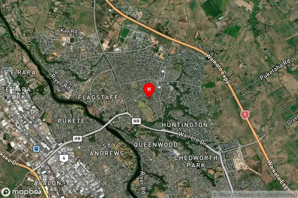
Rototuna Satellite Map
Full Address
Rototuna, Hamilton City, WaikatoRototuna Coordinates
-37.735673,175.269443 (Latitude / Longitude)Rototuna Map in NZ
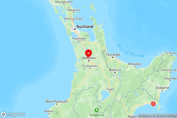
NZ Island
North IslandCountry
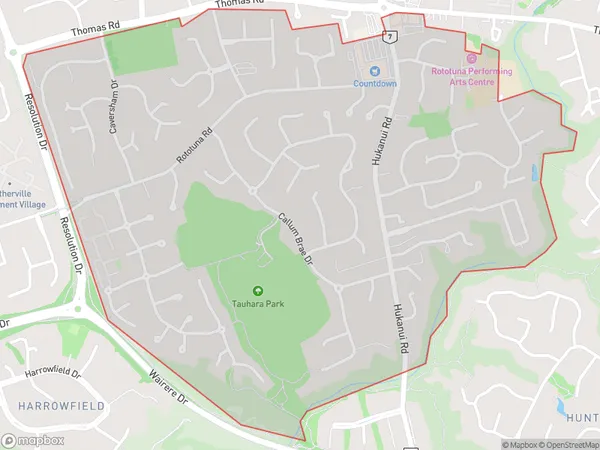
Rototuna Area Map (Polygon)
Name
RototunaAdditional Name
North HuntingtonLocal Authority
Hamilton City
Rototuna Suburbs (Sort by Population)
Rototuna also known as North Huntington. Rototuna suburb has around
2.1 square
kilometers.There are more than 4349 people (estimated)
live in Rototuna, Hamilton, Waikato, New Zealand.