Pakuranga Heights Suburbs & Region, Pakuranga Heights Map & Postcodes in Pakuranga Heights, East Auckland, Auckland, North Island, New Zealand
Pakuranga Heights Postcodes, Pakuranga Heights ZipCodes, Pakuranga Heights , Pakuranga Heights Auckland, Pakuranga Heights Suburbs, Pakuranga Heights Region, Pakuranga Heights Map, Pakuranga Heights Area
Pakuranga Heights Region
Pakuranga Heights Suburbs
Pakuranga Heights is a suburb place type in East Auckland, Auckland, North Island, New Zealand, NZ. It contains 0 suburbs or localities.Pakuranga Heights Postcodes
Pakuranga Heights district
East AucklandPakuranga Heights Region Map
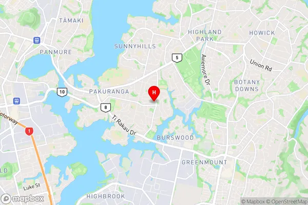
Pakuranga Heights Introduction
Pakuranga Heights is a suburb of Auckland, New Zealand, located in the Eastern Bay of Islands. It is known for its scenic views, lush green parks, and well-maintained homes. The suburb has a population of around 10,000 people and is located approximately 20 kilometers from Auckland City. It is surrounded by several other suburbs, including St Heliers, Remuera, and Glendowie. Pakuranga Heights has a variety of shops, restaurants, and recreational facilities, including a golf course, tennis courts, and a swimming pool. The area is also home to several schools, including Pakuranga College and St Kentigern College.Pakuranga Heights Region
Pakuranga Heights City
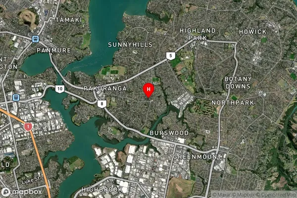
Pakuranga Heights Satellite Map
Full Address
Pakuranga Heights, East Auckland, Auckland, North Island, New ZealandPakuranga Heights Coordinates
-36.914727,174.888467 (Latitude / Longitude)Pakuranga Heights Map in NZ

NZ Island
North IslandCountry