Port Nelson Suburbs & Region, Port Nelson Map & Postcodes in Port Nelson, Nelson, Nelson & Bays
Port Nelson Postcodes, Port Nelson ZipCodes, Port Nelson , Port Nelson Nelson, Port Nelson Suburbs, Port Nelson Region, Port Nelson Map, Port Nelson Area
Port Nelson Region (Nelson Central Region)
Port Nelson Suburbs
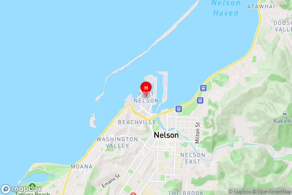
Port Nelson is a suburb place type in Nelson, Nelson & Bays, NZ. It contains 0 suburbs or localities.Port Nelson Region Map
Port Nelson Introduction
Port Nelson is a city in the Nelson Region of New Zealand's South Island. It is the second-largest city in the region and the primary seaport of the region, handling over 80% of New Zealand's export trade. The city is located on the Nelson Bay, which is a sheltered bay and an important recreational and commercial fishing area. The city has a population of around 45,000 people and is known for its historic buildings, including the Nelson Provincial Museum and the Old Government Building. The city also has a number of parks and gardens, including the Trafalgar Park and the Tahunanui Botanical Gardens.Port Nelson Region
Port Nelson City
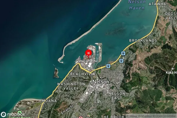
Port Nelson Satellite Map
Full Address
Port Nelson, Nelson, Nelson & BaysPort Nelson Coordinates
-41.261149,173.276582 (Latitude / Longitude)Port Nelson Map in NZ
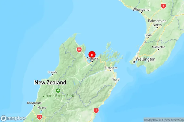
NZ Island
South IslandCountry
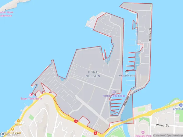
Port Nelson Area Map (Polygon)
Name
Port NelsonAdditional Name
Nelson CentralLocal Authority
Nelson City
Port Nelson Suburbs (Sort by Population)
Port Nelson also known as Nelson Central. Port Nelson suburb has around
1.0 square
kilometers.There are more than 70 people (estimated)
live in Port Nelson, Nelson, Nelson, New Zealand.