Motu Area, Motu Postcode(4052) & Map in Motu
Motu Area, Motu Postcode(4052) & Map in Motu, Gisborne District,
Motu, Gisborne District,
Motu Postcodes
Motu Area (estimated)
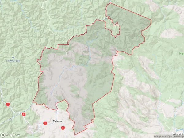
379.3 square kilometersMotu Population (estimated)
87 people live in Motu, Te Karaka, NZMotu Suburb Area Map (Polygon)
Motu Introduction
Motu, Te Karaka, Gisborne, New Zealand, is a small rural settlement located on the eastern coast of the North Island. It is known for its scenic beauty, with lush forests, rolling hills, and a stunning beach. The area is popular with tourists and outdoor enthusiasts, who enjoy activities such as hiking, cycling, and fishing. The settlement also has a rich cultural heritage, with a strong Maori presence and a historic church.Region
Major City
Suburb Name
Motu (Maori Name: Mōtū)Other Name(s)
MoutohoraMotu Area Map (Street)
Local Authority
Gisborne DistrictFull Address
Motu, Gisborne District,Address Type
Locality in Town Te KarakaMotu Suburb Map (Satellite)
Country
Main Region in AU
GisborneMotu Region Map
Coordinates
0,0 (latitude/longitude)Distances
The distance from Motu, Te Karaka, Gisborne District to NZ Top 10 Cities