Waimata Area, Waimata Postcode & Map in Waimata
Waimata Area, Waimata Postcode & Map in Waimata, Gisborne District,
Waimata, Gisborne District,
Waimata Area (estimated)
499.7 square kilometersWaimata Population (estimated)
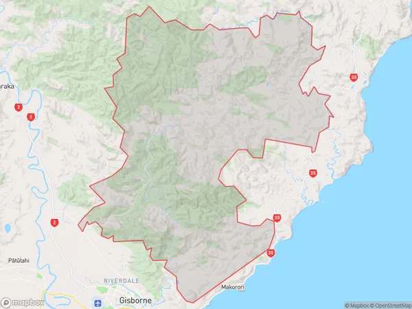
259 people live in Waimata, , NZWaimata Suburb Area Map (Polygon)
Waimata Introduction
Waimata is a small town in the Waikato region of New Zealand, located on the banks of the Waimata River. It is known for its scenic beauty, with rolling hills, lush green fields, and a peaceful atmosphere. The town has a population of around 3,000 people and is a popular destination for outdoor activities such as hiking, fishing, and cycling. It is also home to the Waimata Steam Railway, a heritage railway that runs between Waimata and Waikato Station.00Suburb Name
Waimata (Maori Name: Waimatā)Waimata Area Map (Street)
Local Authority
Gisborne DistrictFull Address
Waimata, Gisborne District,Address Type
Locality in Major Locality WaimataWaimata Suburb Map (Satellite)
Country
Main Region in AU
Waimata Region Map
Coordinates
0,0 (latitude/longitude)Distances
The distance from Waimata, Waimata, Gisborne District to NZ Top 10 Cities