Paripari te tai Bay Area, Paripari te tai Bay Postcode(3074) & Map in Paripari te tai Bay
Paripari te tai Bay Area, Paripari te tai Bay Postcode(3074) & Map in Paripari te tai Bay, Rotorua District, New Zealand
Paripari te tai Bay, Rotorua District, New Zealand
Paripari te tai Bay Postcodes
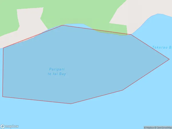
Paripari te tai Bay Area (estimated)
0.3 square kilometersParipari te tai Bay Population (estimated)
0 people live in Paripari te tai Bay, Bay of Plenty, NZParipari te tai Bay Suburb Area Map (Polygon)
Paripari te tai Bay Introduction
Bay of Plenty, New Zealand's largest bay, is known for its warm waters, sandy beaches, and diverse marine life. It is a popular tourist destination and home to several popular cities, including Tauranga, Mount Maunganui, and Papamoa. The bay is also a significant fishing and agricultural area, with a rich history of Māori culture and settlement.Region
Suburb Name
Paripari te tai BayOther Name(s)
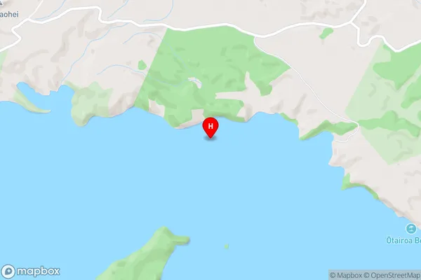
Lake Rotoiti / Te Roto kite a Ihenga i ariki ai Kahu, Lake RotoitiParipari te tai Bay Area Map (Street)
Local Authority
Rotorua DistrictFull Address
Paripari te tai Bay, Rotorua District, New ZealandAddress Type
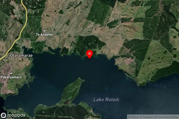
Inland BayParipari te tai Bay Suburb Map (Satellite)
Country
Main Region in AU
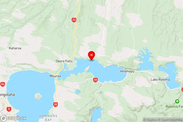
Bay of PlentyParipari te tai Bay Region Map
Coordinates
-38.0176118,176.4077364 (latitude/longitude)Distances
The distance from Paripari te tai Bay, , Rotorua District to NZ Top 10 Cities