Little Mangere Island (Tapuaenuku) The Fort Area, Little Mangere Island (Tapuaenuku) The Fort Postcode & Map in Little Mangere Island (Tapuaenuku) The Fort
Little Mangere Island (Tapuaenuku) The Fort Area, Little Mangere Island (Tapuaenuku) The Fort Postcode & Map in Little Mangere Island (Tapuaenuku) The Fort, Chatham Islands Territory, New Zealand
Little Mangere Island (Tapuaenuku) The Fort, Chatham Islands Territory, New Zealand
Little Mangere Island (Tapuaenuku) The Fort Area (estimated)
0.2 square kilometersLittle Mangere Island (Tapuaenuku) The Fort Population (estimated)
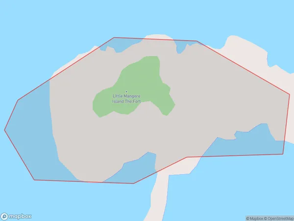
0 people live in Little Mangere Island (Tapuaenuku) The Fort, , NZLittle Mangere Island (Tapuaenuku) The Fort Suburb Area Map (Polygon)
 00
00Suburb Name
Little Mangere Island (Tapuaenuku) The FortLittle Mangere Island (Tapuaenuku) The Fort Area Map (Street)
Local Authority
Chatham Islands TerritoryFull Address
Little Mangere Island (Tapuaenuku) The Fort, Chatham Islands Territory, New ZealandAddress Type
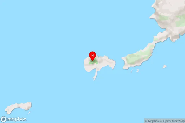
Island in Major Locality Chatham IslandsLittle Mangere Island (Tapuaenuku) The Fort Suburb Map (Satellite)

Country
Main Region in AU
Little Mangere Island (Tapuaenuku) The Fort Region Map

Coordinates
-44.2777085,-176.3174079 (latitude/longitude)Distances
The distance from Little Mangere Island (Tapuaenuku) The Fort, Chatham Islands, Chatham Islands Territory to NZ Top 10 Cities