Hanmer Forest Area, Hanmer Forest Postcode & Map in Hanmer Forest
Hanmer Forest Area, Hanmer Forest Postcode & Map in Hanmer Forest, Hurunui District, New Zealand
Hanmer Forest, Hurunui District, New Zealand
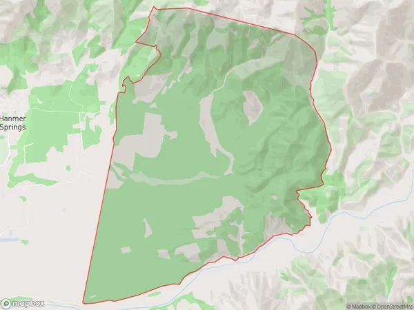
Hanmer Forest Area (estimated)
45.3 square kilometersHanmer Forest Population (estimated)
2 people live in Hanmer Forest, Canterbury, NZHanmer Forest Suburb Area Map (Polygon)
Hanmer Forest Introduction
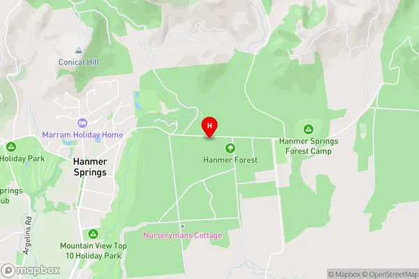
Hanmer Forest is a popular tourist destination in Hanmer Springs, Canterbury, New Zealand. It is known for its hot springs, scenic walks, and mountain biking trails. The forest covers an area of 2,500 hectares and is home to a variety of plant and animal species, including the rare Hector's dolphin. Visitors can enjoy soaking in the natural hot pools, exploring the forest trails, or taking part in outdoor activities such as mountain biking and hiking.Region
Major City
Suburb Name
Hanmer ForestHanmer Forest Area Map (Street)
Local Authority
Hurunui DistrictFull Address
Hanmer Forest, Hurunui District, New ZealandAddress Type
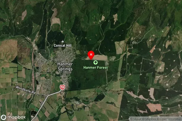
Suburb in Town Hanmer SpringsHanmer Forest Suburb Map (Satellite)
Country
Main Region in AU
CanterburyHanmer Forest Region Map

Coordinates
-42.51931305,172.84497821535 (latitude/longitude)Distances
The distance from Hanmer Forest, Hanmer Springs, Hurunui District to NZ Top 10 Cities