Oneroa Area, Oneroa Postcode(1081) & Map in Oneroa
Oneroa Area, Oneroa Postcode(1081) & Map in Oneroa, Auckland, New Zealand
Oneroa, Auckland, New Zealand
Oneroa Area (estimated)
7.0 square kilometersOneroa Population (estimated)
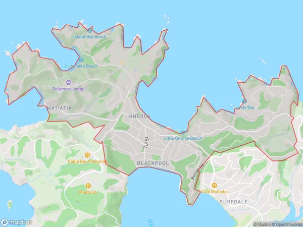
2326 people live in Oneroa, Aotea Great Barrier, NZOneroa Suburb Area Map (Polygon)
Oneroa Introduction
Oneroa is a picturesque beach village on Waiheke Island, located just off the coast of Auckland, New Zealand. It is known for its stunning white sand beaches, lush green vineyards, and charming cafes. The village has a laid-back atmosphere and is a popular destination for tourists and locals alike. It is also home to a variety of wildlife, including penguins, sea birds, and dolphins.Region
Major City
Suburb Name
OneroaOther Name(s)
BlackpoolOneroa Area Map (Street)
Local Authority
AucklandFull Address
Oneroa, Auckland, New ZealandAddress Type
Suburb in Town Waiheke IslandOneroa Suburb Map (Satellite)
Country
Main Region in AU
AucklandOneroa Region Map
Coordinates
-36.1212727,175.3677516 (latitude/longitude)Distances
The distance from Oneroa, Waiheke Island, Auckland to NZ Top 10 Cities