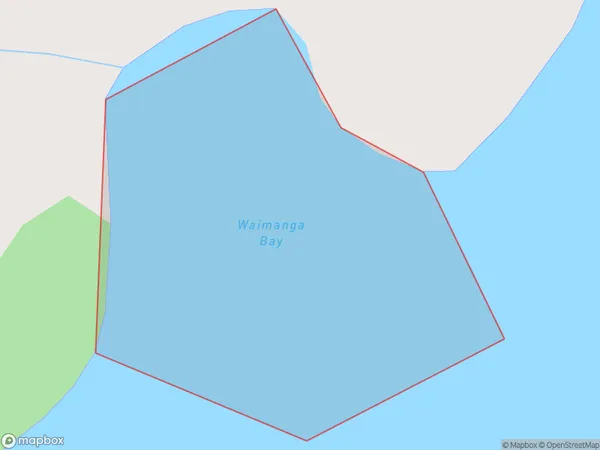
Waimanga Bay Area, Waimanga Bay Postcode(1971) & Map in Waimanga Bay
Waimanga Bay Area, Waimanga Bay Postcode(1971) & Map in Waimanga Bay, Auckland, New Zealand
Waimanga Bay, Auckland, New Zealand
Waimanga Bay Postcodes
Waimanga Bay Area (estimated)
0.1 square kilometersWaimanga Bay Population (estimated)
0 people live in Waimanga Bay, Waiheke, NZWaimanga Bay Suburb Area Map (Polygon)
Waimanga Bay Introduction
Waimanga Bay is a picturesque and tranquil coastal village located in the Auckland region of New Zealand. It is known for its stunning natural beauty, including crystal-clear waters, white sandy beaches, and lush green forests. The bay is a popular destination for swimming, kayaking, and fishing, and it is also home to a variety of wildlife, including seals, penguins, and dolphins. The village has a relaxed and laid-back atmosphere, with a few cafes and restaurants serving fresh seafood and local produce. Waimanga Bay is located about 45 minutes drive from Auckland City and is easily accessible by car or public transport.Region
Major City
Suburb Name
Waimanga BayOther Name(s)
Awaawaroa Bay, Hauraki GulfWaimanga Bay Area Map (Street)
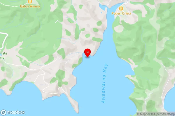
Local Authority
AucklandFull Address
Waimanga Bay, Auckland, New ZealandAddress Type
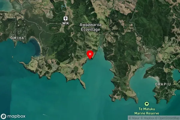
Coastal BayWaimanga Bay Suburb Map (Satellite)
Country
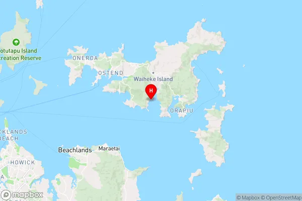
Main Region in AU
AucklandWaimanga Bay Region Map
Coordinates
-36.8282989,175.0998681 (latitude/longitude)Distances
The distance from Waimanga Bay, , Auckland to NZ Top 10 Cities