Endeavour Inlet Area, Endeavour Inlet Postcode & Map in Endeavour Inlet
Endeavour Inlet Area, Endeavour Inlet Postcode & Map in Endeavour Inlet, Marlborough District, New Zealand
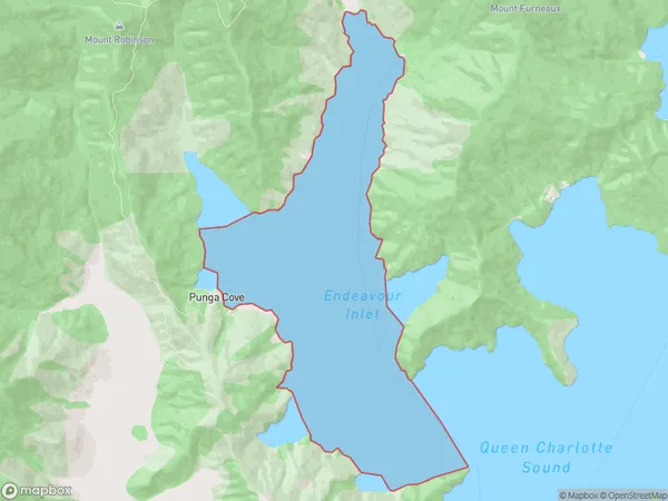
Endeavour Inlet, Marlborough District, New Zealand
Endeavour Inlet Area (estimated)
15.3 square kilometersEndeavour Inlet Population (estimated)
0 people live in Endeavour Inlet, Marlborough, NZEndeavour Inlet Suburb Area Map (Polygon)
Endeavour Inlet Introduction
Endeavour Inlet is located in Marlborough, New Zealand. It was named after Captain James Cook's ship, HMS Endeavour, which visited the area in 1769. The inlet is a popular spot for boating, fishing, and swimming, and it is home to a variety of wildlife, including seals, dolphins, and penguins.Region
Suburb Name
Endeavour InletOther Name(s)
Queen Charlotte Sound (Totaranui)Endeavour Inlet Area Map (Street)

Local Authority
Marlborough DistrictFull Address
Endeavour Inlet, Marlborough District, New ZealandAddress Type
Coastal BayEndeavour Inlet Suburb Map (Satellite)

Country
Main Region in AU
MarlboroughEndeavour Inlet Region Map

Coordinates
-41.12235915,174.166223858683 (latitude/longitude)Distances
The distance from Endeavour Inlet, , Marlborough District to NZ Top 10 Cities