Takutairaroa Bay Area, Takutairaroa Bay Postcode(0622) & Map in Takutairaroa Bay
Takutairaroa Bay Area, Takutairaroa Bay Postcode(0622) & Map in Takutairaroa Bay, Auckland, New Zealand
Takutairaroa Bay, Auckland, New Zealand
Takutairaroa Bay Postcodes
Takutairaroa Bay Area (estimated)
0.9 square kilometersTakutairaroa Bay Population (estimated)
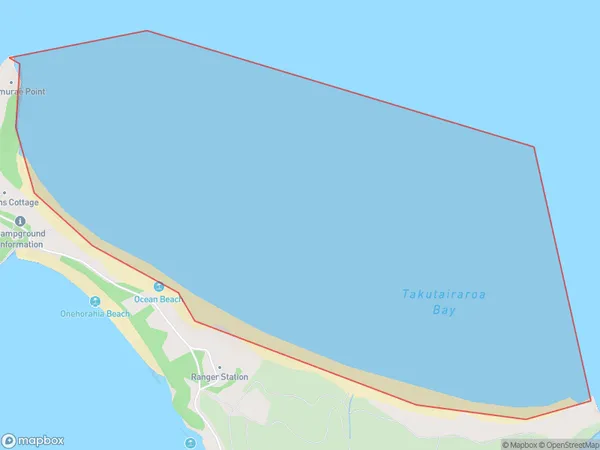
0 people live in Takutairaroa Bay, Waiheke, NZTakutairaroa Bay Suburb Area Map (Polygon)
Takutairaroa Bay Introduction
Takutairaroa Bay is a small, sheltered bay located in the Auckland region of New Zealand. It is known for its clear waters, sandy beaches, and stunning coastal scenery. The bay is a popular spot for swimming, kayaking, and fishing, and is also home to a small community of residents. The bay is surrounded by lush green hills and is located within the Takutai Forest Park, which offers a range of outdoor activities such as hiking, mountain biking, and picnicking.Region
Major City
Suburb Name
Takutairaroa BayOther Name(s)
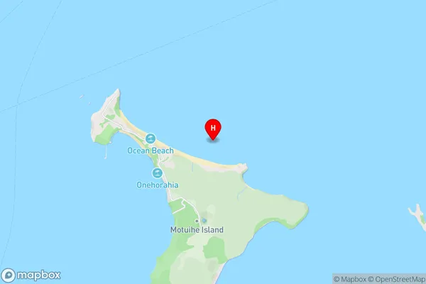
Hauraki GulfTakutairaroa Bay Area Map (Street)
Local Authority
AucklandFull Address
Takutairaroa Bay, Auckland, New ZealandAddress Type
Coastal BayTakutairaroa Bay Suburb Map (Satellite)

Country
Main Region in AU
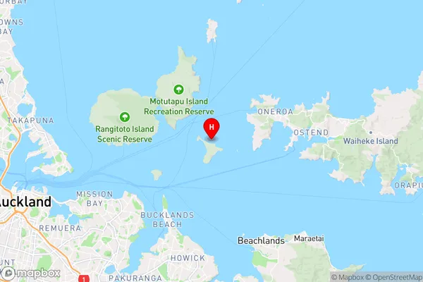
AucklandTakutairaroa Bay Region Map
Coordinates
-36.8047831,174.9478434 (latitude/longitude)Distances
The distance from Takutairaroa Bay, , Auckland to NZ Top 10 Cities