Stead Bay Area, Stead Bay Postcode & Map in Stead Bay
Stead Bay Area, Stead Bay Postcode & Map in Stead Bay, Area outside Territorial Authority, New Zealand
Stead Bay, Area outside Territorial Authority, New Zealand
Stead Bay Area (estimated)
0.0 square kilometersStead Bay Population (estimated)
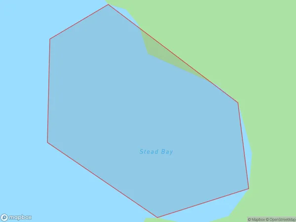
0 people live in Stead Bay, Northland, NZStead Bay Suburb Area Map (Polygon)
Stead Bay Introduction
Stead Bay is a small bay located in the Northland region of New Zealand. It is situated between the towns of Kaitaia and Northland, and is known for its stunning natural beauty, including rugged cliffs, pristine beaches, and abundant marine life. The bay is a popular destination for fishing, kayaking, and hiking, and is home to a small community of residents who rely on the tourism industry for their livelihood.Region
Suburb Name
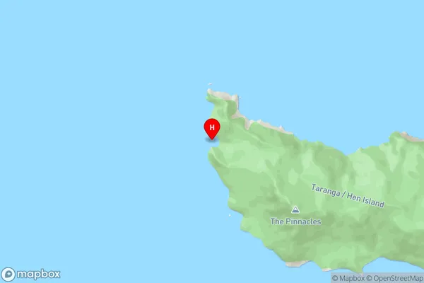
Stead BayStead Bay Area Map (Street)
Local Authority
Area outside Territorial AuthorityFull Address
Stead Bay, Area outside Territorial Authority, New ZealandAddress Type
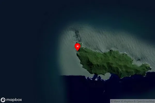
Coastal BayStead Bay Suburb Map (Satellite)
Country
Main Region in AU
NorthlandStead Bay Region Map

Coordinates
-35.9575292,174.6974439 (latitude/longitude)Distances
The distance from Stead Bay, , Area outside Territorial Authority to NZ Top 10 Cities