Otupoho Bay Area, Otupoho Bay Postcode & Map in Otupoho Bay
Otupoho Bay Area, Otupoho Bay Postcode & Map in Otupoho Bay, Far North District, New Zealand
Otupoho Bay, Far North District, New Zealand
Otupoho Bay Area (estimated)
0.0 square kilometersOtupoho Bay Population (estimated)
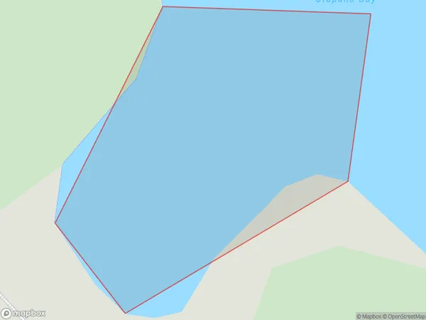
0 people live in Otupoho Bay, Bay of Islands-Whangaroa Community, NZOtupoho Bay Suburb Area Map (Polygon)
Otupoho Bay Introduction
Otupoho Bay is a small bay located in the Northland region of New Zealand. It is known for its stunning natural beauty, including rugged cliffs, pristine beaches, and diverse marine life. The bay is a popular destination for tourists and outdoor enthusiasts, with opportunities for hiking, kayaking, and fishing. It is also home to a small community of residents who rely on the bay's natural resources for their livelihood.Region
Major City
Suburb Name
Otupoho BayOther Name(s)
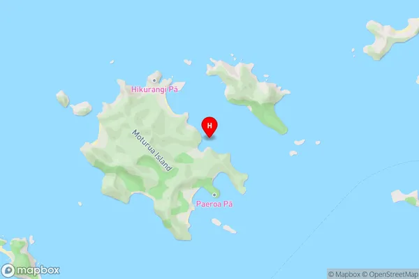
Bay Of IslandsOtupoho Bay Area Map (Street)
Local Authority
Far North DistrictFull Address
Otupoho Bay, Far North District, New ZealandAddress Type
Coastal BayOtupoho Bay Suburb Map (Satellite)
Not available for nowCountry
Main Region in AU
NorthlandOtupoho Bay Region Map

Coordinates
-35.2220731,174.1977443 (latitude/longitude)Distances
The distance from Otupoho Bay, , Far North District to NZ Top 10 Cities