Mercury Bay Area, Mercury Bay Postcode(3510) & Map in Mercury Bay
Mercury Bay Area, Mercury Bay Postcode(3510) & Map in Mercury Bay, Area outside Territorial Authority, New Zealand
Mercury Bay, Area outside Territorial Authority, New Zealand
Mercury Bay Postcodes
Mercury Bay Area (estimated)
19.8 square kilometersMercury Bay Population (estimated)
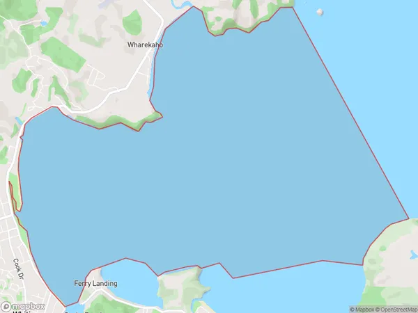
0 people live in Mercury Bay, Waikato, NZMercury Bay Suburb Area Map (Polygon)
Mercury Bay Introduction
Mercury Bay is a popular beach destination on the Coromandel Peninsula in Waikato, New Zealand. It is known for its white sand, clear waters, and stunning coastal scenery. The bay is a popular spot for swimming, surfing, and fishing, and there are several campgrounds and holiday parks in the area. The nearby town of Whitianga is a popular tourist destination and offers a range of restaurants, cafes, and shops.Region
Major City
Suburb Name
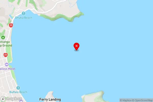
Mercury BayMercury Bay Area Map (Street)
Local Authority
Area outside Territorial AuthorityFull Address
Mercury Bay, Area outside Territorial Authority, New ZealandAddress Type
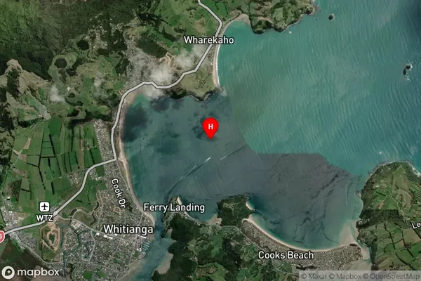
Coastal BayMercury Bay Suburb Map (Satellite)
Country
Main Region in AU
WaikatoMercury Bay Region Map

Coordinates
-36.8158558,175.7226052 (latitude/longitude)Distances
The distance from Mercury Bay, , Area outside Territorial Authority to NZ Top 10 Cities