Lauras Leg Area, Lauras Leg Postcode & Map in Lauras Leg
Lauras Leg Area, Lauras Leg Postcode & Map in Lauras Leg, Area outside Territorial Authority, New Zealand
Lauras Leg, Area outside Territorial Authority, New Zealand
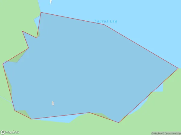
Lauras Leg Area (estimated)
0.1 square kilometersLauras Leg Population (estimated)
0 people live in Lauras Leg, Southland, NZLauras Leg Suburb Area Map (Polygon)
Lauras Leg Introduction
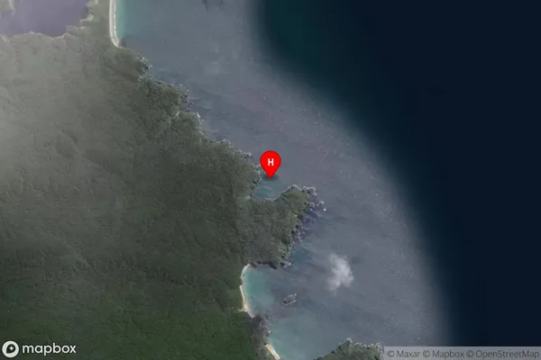
Lauras Leg is a small rock formation located in Fiordland National Park, Southland, New Zealand. It is known for its distinctive shape and is a popular tourist attraction. The rock formation is believed to have been formed by volcanic activity and is named after a Scottish sailor who is said to have stumbled upon it while sailing in the area in the 18th century.Region
Suburb Name
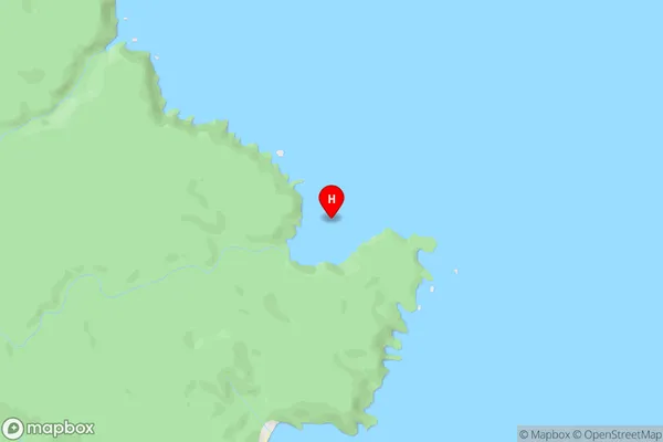
Lauras LegLauras Leg Area Map (Street)
Local Authority
Area outside Territorial AuthorityFull Address
Lauras Leg, Area outside Territorial Authority, New ZealandAddress Type
Coastal BayLauras Leg Suburb Map (Satellite)
Country
Main Region in AU
SouthlandLauras Leg Region Map

Coordinates
-46.9923707,168.2077608 (latitude/longitude)Distances
The distance from Lauras Leg, , Area outside Territorial Authority to NZ Top 10 Cities