Maihiihi Area, Maihiihi Postcode(3972) & Map in Maihiihi
Maihiihi Area, Maihiihi Postcode(3972) & Map in Maihiihi, Otorohanga District, New Zealand
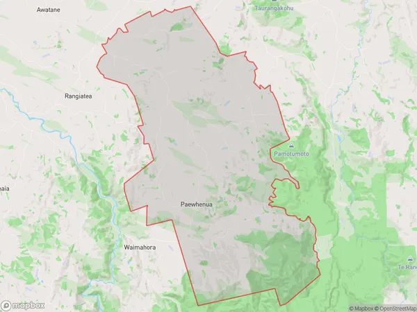
Maihiihi, Otorohanga District, New Zealand
Maihiihi Area (estimated)
144.2 square kilometersMaihiihi Population (estimated)
443 people live in Maihiihi, Waikato, NZMaihiihi Suburb Area Map (Polygon)
Maihiihi Introduction
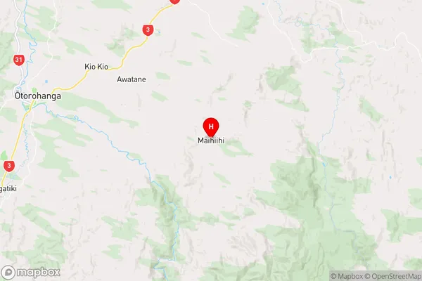
Maihiihi is a small rural community in the Waikato region of New Zealand, located approximately 30 kilometers south of Otorohanga. It is known for its picturesque rural setting, with rolling hills, lush green fields, and a peaceful atmosphere. The community has a population of around 100 people and is home to a primary school, a church, and a few small businesses. Maihiihi is surrounded by stunning natural scenery, including the Waikato River and the Taranaki Mountains, and is popular with outdoor enthusiasts and nature lovers.Region
Major City
Suburb Name
MaihiihiOther Name(s)
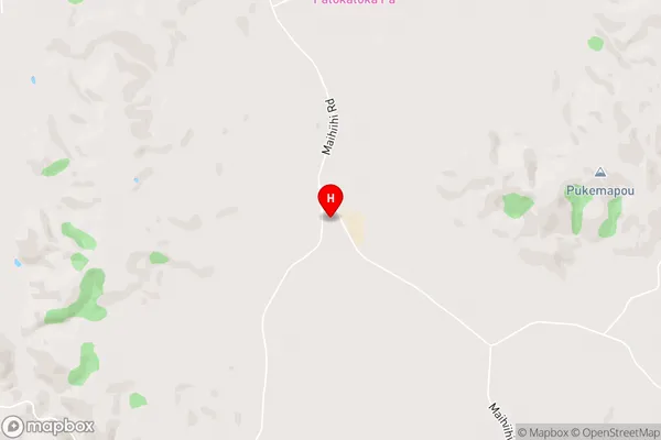
Mangatutu, Paewhenua, TauraroaMaihiihi Area Map (Street)
Local Authority
Otorohanga District (Maori Name: Ōtorohanga District)Full Address
Maihiihi, Otorohanga District, New ZealandAddress Type
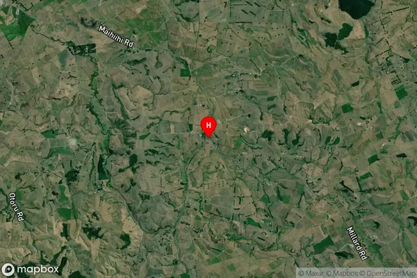
Locality in Town OtorohangaMaihiihi Suburb Map (Satellite)
Country
Main Region in AU
WaikatoMaihiihi Region Map
Coordinates
-38.2166642,175.3846333 (latitude/longitude)Distances
The distance from Maihiihi, Otorohanga, Otorohanga District to NZ Top 10 Cities