Wharetata Bay Area, Wharetata Bay Postcode(3074) & Map in Wharetata Bay
Wharetata Bay Area, Wharetata Bay Postcode(3074) & Map in Wharetata Bay, Rotorua District, New Zealand
Wharetata Bay, Rotorua District, New Zealand
Wharetata Bay Postcodes
Wharetata Bay Area (estimated)
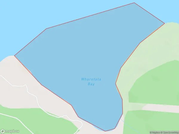
0.5 square kilometersWharetata Bay Population (estimated)
0 people live in Wharetata Bay, Bay of Plenty, NZWharetata Bay Suburb Area Map (Polygon)
Wharetata Bay Introduction
Wharetata Bay is located in the Bay of Plenty region of New Zealand. It is a popular spot for swimming, boating, and fishing, with a beautiful beach and clear waters. The bay is also home to a small community of residents and a historic wharf.Region
Suburb Name
Wharetata BayOther Name(s)
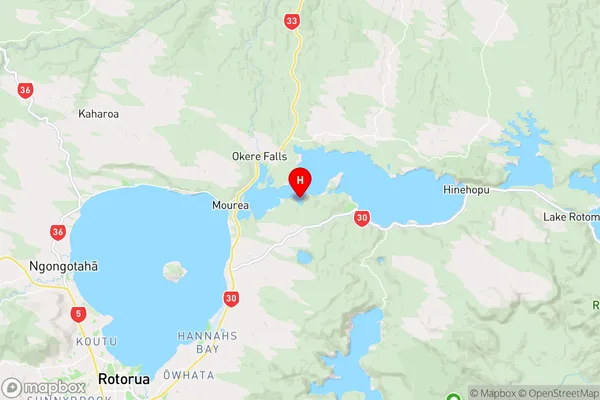
Lake Rotoiti / Te Roto kite a Ihenga i ariki ai Kahu, Lake RotoitiWharetata Bay Area Map (Street)

Local Authority
Rotorua DistrictFull Address
Wharetata Bay, Rotorua District, New ZealandAddress Type
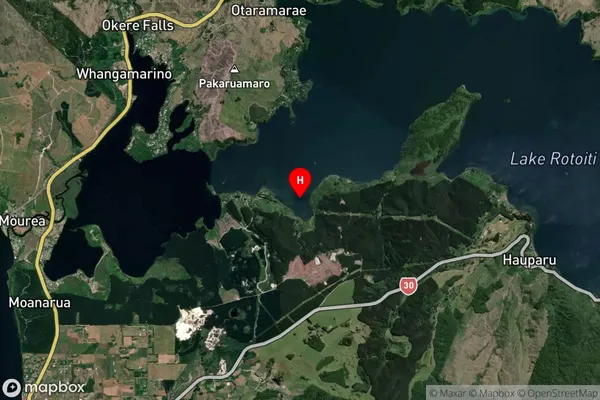
Inland BayWharetata Bay Suburb Map (Satellite)
Country
Main Region in AU
Bay of PlentyWharetata Bay Region Map
Coordinates
-38.0413907,176.373913 (latitude/longitude)Distances
The distance from Wharetata Bay, , Rotorua District to NZ Top 10 Cities