Waiharakeke Bay Area, Waiharakeke Bay Postcode & Map in Waiharakeke Bay
Waiharakeke Bay Area, Waiharakeke Bay Postcode & Map in Waiharakeke Bay, Tasman District, New Zealand
Waiharakeke Bay, Tasman District, New Zealand
Waiharakeke Bay Area (estimated)
0.6 square kilometersWaiharakeke Bay Population (estimated)
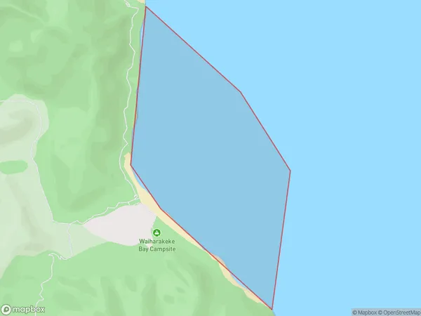
0 people live in Waiharakeke Bay, Tasman, NZWaiharakeke Bay Suburb Area Map (Polygon)
Waiharakeke Bay Introduction
Waiharakeke Bay is a small, sheltered bay located in the Tasman region of New Zealand. It is known for its beautiful native bush, crystal-clear waters, and stunning coastal scenery. The bay is a popular spot for swimming, kayaking, and fishing, and is home to a variety of bird species. The surrounding area is also home to several historic sites, including the Waiharakeke Island Sanctuary, which is a wildlife reserve and nature reserve.Region
Suburb Name
Waiharakeke BayOther Name(s)
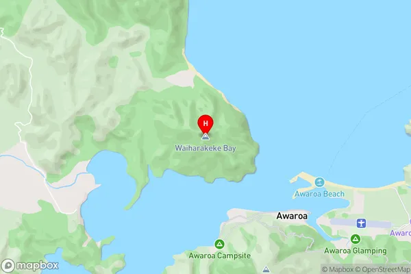
Tasman BayWaiharakeke Bay Area Map (Street)
Local Authority
Tasman DistrictFull Address
Waiharakeke Bay, Tasman District, New ZealandAddress Type
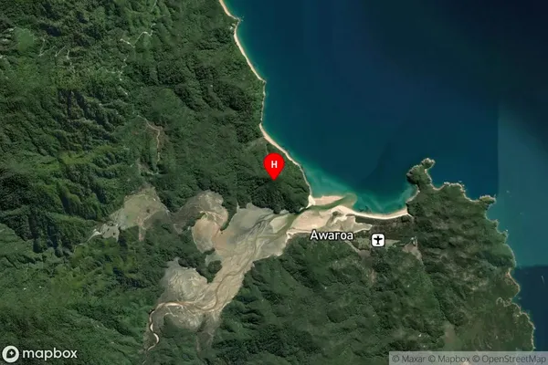
Coastal BayWaiharakeke Bay Suburb Map (Satellite)
Country
Main Region in AU
TasmanWaiharakeke Bay Region Map

Coordinates
-40.854684,173.016828 (latitude/longitude)Distances
The distance from Waiharakeke Bay, , Tasman District to NZ Top 10 Cities