Te Wahapu Inlet Area, Te Wahapu Inlet Postcode(0202) & Map in Te Wahapu Inlet
Te Wahapu Inlet Area, Te Wahapu Inlet Postcode(0202) & Map in Te Wahapu Inlet, Far North District, New Zealand
Te Wahapu Inlet, Far North District, New Zealand
Te Wahapu Inlet Postcodes
Te Wahapu Inlet Area (estimated)
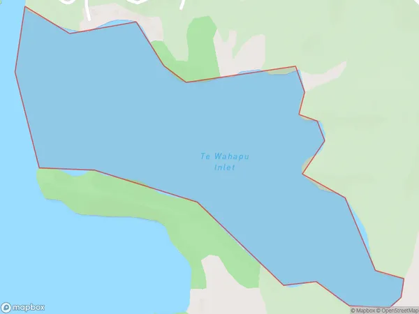
0.6 square kilometersTe Wahapu Inlet Population (estimated)
0 people live in Te Wahapu Inlet, Bay of Islands-Whangaroa Community, NZTe Wahapu Inlet Suburb Area Map (Polygon)
Te Wahapu Inlet Introduction
Te Wahapu Inlet is located in the Bay of Islands, Northland, New Zealand. It is a popular tourist destination known for its clear waters, sandy beaches, and stunning natural scenery. The inlet is surrounded by rugged cliffs and dense forests, and is home to a variety of marine species, including dolphins, whales, and seals. Visitors can explore the inlet by boat, kayak, or hiking trails, and can also visit the nearby Te Papa Museum, which showcases the region's cultural and historical heritage.Region
Major City
Suburb Name
Te Wahapu InletOther Name(s)
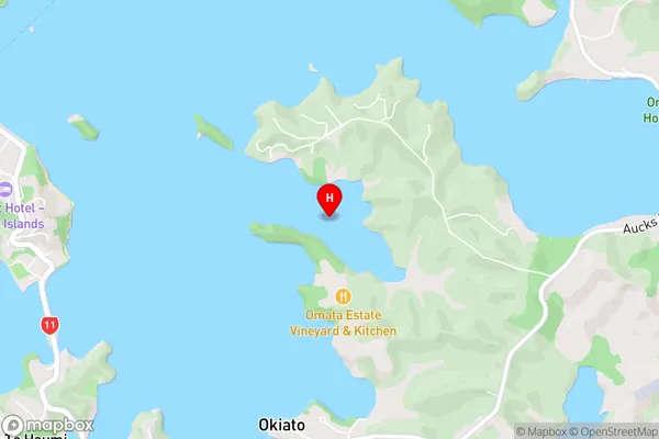
Bay Of IslandsTe Wahapu Inlet Area Map (Street)
Local Authority
Far North DistrictFull Address
Te Wahapu Inlet, Far North District, New ZealandAddress Type
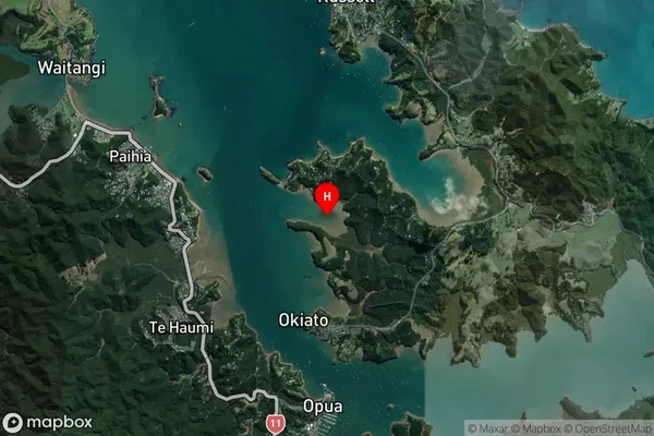
Coastal BayTe Wahapu Inlet Suburb Map (Satellite)
Country
Main Region in AU
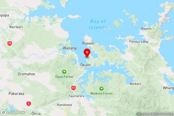
NorthlandTe Wahapu Inlet Region Map
Coordinates
-35.2897936,174.120681 (latitude/longitude)Distances
The distance from Te Wahapu Inlet, , Far North District to NZ Top 10 Cities