Te Okoriki Inlet Area, Te Okoriki Inlet Postcode(0618) & Map in Te Okoriki Inlet
Te Okoriki Inlet Area, Te Okoriki Inlet Postcode(0618) & Map in Te Okoriki Inlet, Auckland, New Zealand
Te Okoriki Inlet, Auckland, New Zealand
Te Okoriki Inlet Postcodes
Te Okoriki Inlet Area (estimated)
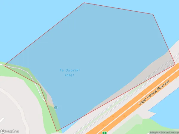
0.1 square kilometersTe Okoriki Inlet Population (estimated)
0 people live in Te Okoriki Inlet, Upper Harbour, NZTe Okoriki Inlet Suburb Area Map (Polygon)
Te Okoriki Inlet Introduction
Te Okoriki Inlet is a small, sheltered inlet located in the Waitemata Harbour of Auckland, New Zealand. It is known for its beautiful beaches, crystal-clear waters, and diverse marine life. The inlet is a popular spot for swimming, kayaking, and paddleboarding, and it is also home to a small community of residents. The area is surrounded by lush green hills and is a popular destination for day trips and weekend getaways.Region
Major City
Suburb Name
Te Okoriki InletOther Name(s)
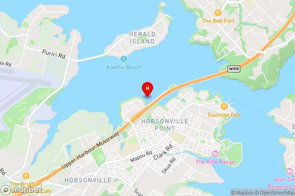
Waitemata Harbour, Hauraki Gulf (Maori Name: Waitematā Harbour, Hauraki Gulf)Te Okoriki Inlet Area Map (Street)
Local Authority
AucklandFull Address
Te Okoriki Inlet, Auckland, New ZealandAddress Type
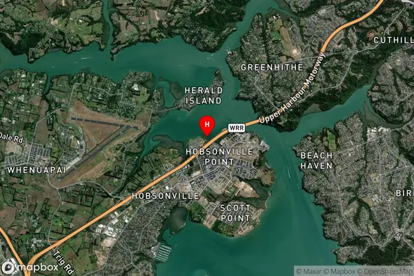
Coastal BayTe Okoriki Inlet Suburb Map (Satellite)
Country
Main Region in AU
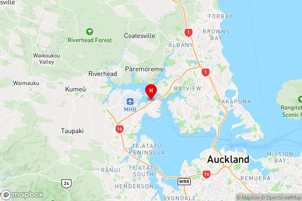
AucklandTe Okoriki Inlet Region Map
Coordinates
-36.7876902,174.6577743 (latitude/longitude)Distances
The distance from Te Okoriki Inlet, , Auckland to NZ Top 10 Cities