Sunday Cove Area, Sunday Cove Postcode & Map in Sunday Cove
Sunday Cove Area, Sunday Cove Postcode & Map in Sunday Cove, Southland District, New Zealand
Sunday Cove, Southland District, New Zealand
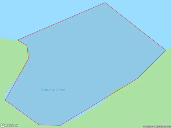
Sunday Cove Area (estimated)
0.2 square kilometersSunday Cove Population (estimated)
0 people live in Sunday Cove, Southland, NZSunday Cove Suburb Area Map (Polygon)
Sunday Cove Introduction
Sunday Cove is a small beach located in Fiordland National Park in Southland, New Zealand. It is known for its crystal-clear waters, stunning rock formations, and peaceful atmosphere, making it a popular spot for swimming, kayaking, and hiking. The cove is surrounded by dense forest and towering mountains, providing a sense of isolation and tranquility. It is accessible only by a short boat ride or a challenging hike, adding to its allure and sense of adventure.Region
Suburb Name
Sunday CoveOther Name(s)
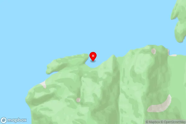
Te Puaitaha / Breaksea SoundSunday Cove Area Map (Street)
Local Authority
Southland DistrictFull Address
Sunday Cove, Southland District, New ZealandAddress Type
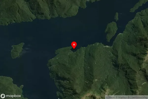
Coastal BaySunday Cove Suburb Map (Satellite)
Country
Main Region in AU
SouthlandSunday Cove Region Map

Coordinates
-45.5952281,166.7418761 (latitude/longitude)Distances
The distance from Sunday Cove, , Southland District to NZ Top 10 Cities