Shoal Bay Area, Shoal Bay Postcode(8081) & Map in Shoal Bay
Shoal Bay Area, Shoal Bay Postcode(8081) & Map in Shoal Bay, Hurunui District, New Zealand
Shoal Bay, Hurunui District, New Zealand
Shoal Bay Postcodes
Shoal Bay Area (estimated)
0.3 square kilometersShoal Bay Population (estimated)
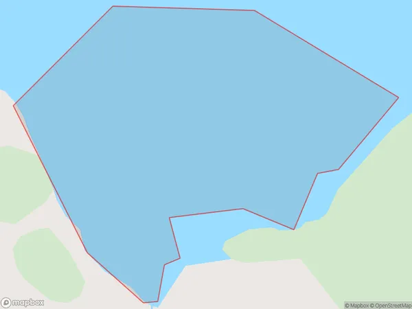
0 people live in Shoal Bay, Canterbury, NZShoal Bay Suburb Area Map (Polygon)
Shoal Bay Introduction
Shoal Bay is a picturesque beach located in the Canterbury region of New Zealand. It is known for its crystal-clear waters, stunning coastal views, and peaceful atmosphere. The bay is a popular spot for swimming, kayaking, and fishing, and it is surrounded by lush green hills and native forests. Visitors can also enjoy a walk along the beach or explore the nearby Shoal Bay Conservation Park, which is home to a variety of wildlife and plant species.Region
Suburb Name
Shoal BayOther Name(s)
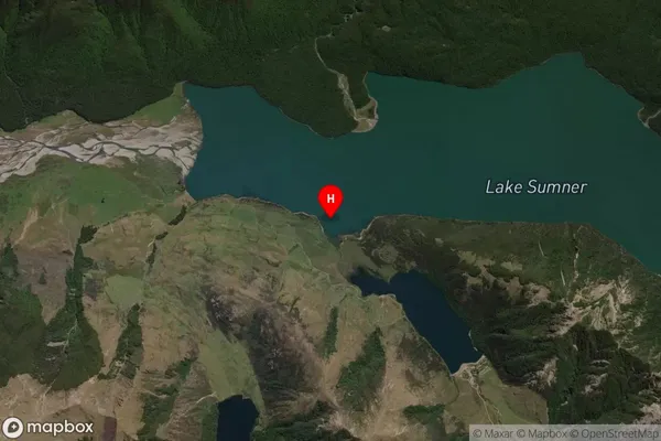
Lake SumnerShoal Bay Area Map (Street)

Local Authority
Hurunui DistrictFull Address
Shoal Bay, Hurunui District, New ZealandAddress Type
Inland BayShoal Bay Suburb Map (Satellite)
Country
Main Region in AU
CanterburyShoal Bay Region Map

Coordinates
-42.707083,172.184083 (latitude/longitude)Distances
The distance from Shoal Bay, , Hurunui District to NZ Top 10 Cities