Paremata Bay Area, Paremata Bay Postcode(3010) & Map in Paremata Bay
Paremata Bay Area, Paremata Bay Postcode(3010) & Map in Paremata Bay, Rotorua District, New Zealand
Paremata Bay, Rotorua District, New Zealand
Paremata Bay Postcodes
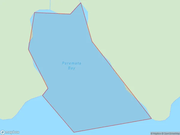
Paremata Bay Area (estimated)
0.1 square kilometersParemata Bay Population (estimated)
0 people live in Paremata Bay, Bay of Plenty, NZParemata Bay Suburb Area Map (Polygon)
Paremata Bay Introduction
Paremata Bay is a popular beach in the Bay of Plenty, New Zealand. It is known for its clear waters, white sand, and stunning sunsets. The bay is also a popular spot for swimming, snorkeling, and kayaking. There are several cafes and restaurants in the area, as well as a campground and holiday park. Paremata Bay is a must-visit destination for anyone visiting the Bay of Plenty.Region
Suburb Name
Paremata BayOther Name(s)
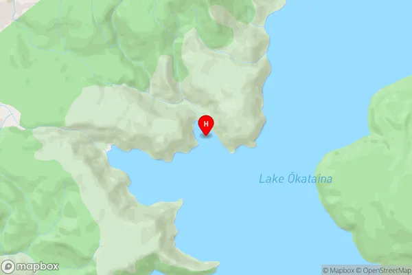
Lake Okataina / Te Moana i kataina a Te Rangitakaroro, Lake Okataina/Te Moana i kataina a Te Rangitakaroro (Maori Name: Lake Okataina / Te Moana i kataina a Te Rangitakaroro, Lake Ōkataina/Te Moana i kataina ā Te Rangitakaroro)Paremata Bay Area Map (Street)
Local Authority
Rotorua DistrictFull Address
Paremata Bay, Rotorua District, New ZealandAddress Type
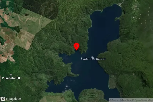
Inland BayParemata Bay Suburb Map (Satellite)
Country
Main Region in AU
Bay of PlentyParemata Bay Region Map
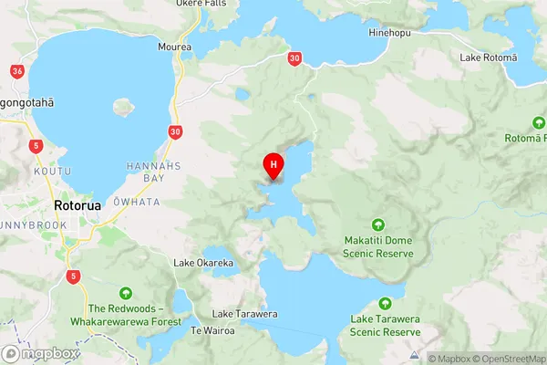
Coordinates
-38.1245633,176.4006042 (latitude/longitude)Distances
The distance from Paremata Bay, , Rotorua District to NZ Top 10 Cities